You are here: Home > Network List > TA - USArray Transportable Network (new EarthScope stations) Stations List
> Station J01E Myrtle Point, OR, USA > Earthquake Result Viewer
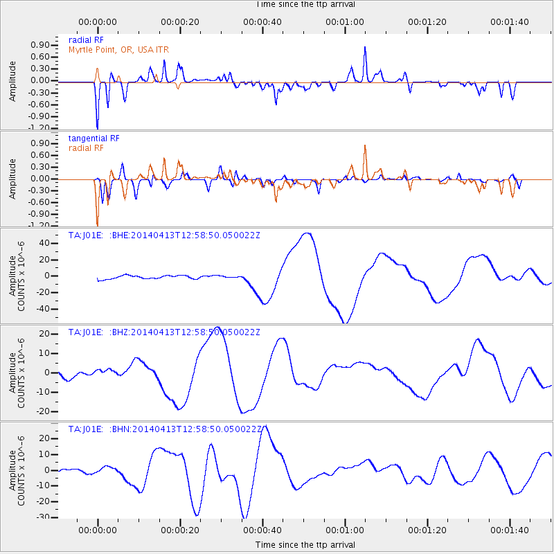
J01E Myrtle Point, OR, USA - Earthquake Result Viewer
*The percent match for this event was below the threshold and hence no stack was calculated.
| Earthquake location: |
Solomon Islands |
| Earthquake latitude/longitude: |
-11.5/162.3 |
| Earthquake time(UTC): |
2014/04/13 (103) 12:46:43 GMT |
| Earthquake Depth: |
31 km |
| Earthquake Magnitude: |
5.7 MB |
| Earthquake Catalog/Contributor: |
NEIC PDE/NEIC COMCAT |
|
| Network: |
TA USArray Transportable Network (new EarthScope stations) |
| Station: |
J01E Myrtle Point, OR, USA |
| Lat/Lon: |
43.16 N/123.93 W |
| Elevation: |
128 m |
|
| Distance: |
86.2 deg |
| Az: |
44.749 deg |
| Baz: |
250.595 deg |
| Ray Param: |
$rayparam |
*The percent match for this event was below the threshold and hence was not used in the summary stack. |
|
| Radial Match: |
44.20753 % |
| Radial Bump: |
310 |
| Transverse Match: |
53.69922 % |
| Transverse Bump: |
400 |
| SOD ConfigId: |
626651 |
| Insert Time: |
2014-04-27 13:19:27.672 +0000 |
| GWidth: |
2.5 |
| Max Bumps: |
400 |
| Tol: |
0.001 |
|
Signal To Noise
| Channel | StoN | STA | LTA |
| TA:J01E: :BHZ:20140413T12:58:50.050022Z | 0.763168 | 1.6023007E-6 | 2.0995387E-6 |
| TA:J01E: :BHN:20140413T12:58:50.050022Z | 2.2627742 | 2.249444E-6 | 9.941089E-7 |
| TA:J01E: :BHE:20140413T12:58:50.050022Z | 0.5314209 | 1.1148165E-6 | 2.0978034E-6 |
| Arrivals |
| Ps | |
| PpPs | |
| PsPs/PpSs | |


