KDAK Kodiak Island, Alaska, USA - Earthquake Result Viewer
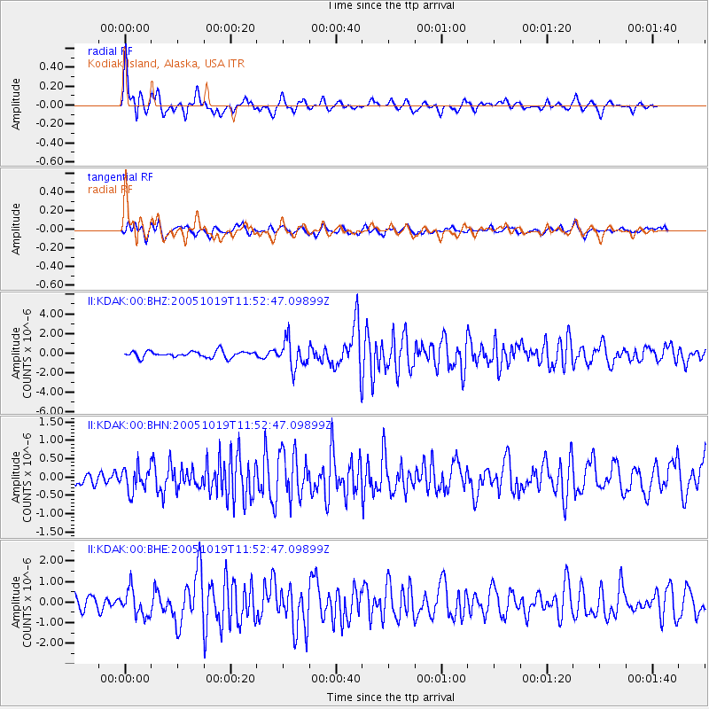
Earthquake location: Near East Coast Of Honshu, Japan
Earthquake latitude/longitude: 36.4/140.8
Earthquake time(UTC): 2005/10/19 (292) 11:44:42 GMT
Earthquake Depth: 32 km
Earthquake Magnitude: 6.2 MB, 6.5 MS, 6.4 MW, 6.3 MW
Earthquake Catalog/Contributor: WHDF/NEIC
Network: II Global Seismograph Network (GSN - IRIS/IDA)
Station: KDAK Kodiak Island, Alaska, USA
Lat/Lon: 57.78 N/152.58 W
Elevation: 152 m
Distance: 47.9 deg
Az: 41.511 deg
Baz: 273.537 deg
Ray Param: 0.06965501
Estimated Moho Depth: 29.0 km
Estimated Crust Vp/Vs: 2.04
Assumed Crust Vp: 6.134 km/s
Estimated Crust Vs: 3.003 km/s
Estimated Crust Poisson's Ratio: 0.34
Radial Match: 80.15257 %
Radial Bump: 400
Transverse Match: 63.46024 %
Transverse Bump: 400
SOD ConfigId: 2475
Insert Time: 2010-03-01 20:59:46.388 +0000
GWidth: 2.5
Max Bumps: 400
Tol: 0.001

Signal To Noise

ChannelStoNSTALTA
II:KDAK:00:BHN:20051019T11:52:47.09899Z0.91678223.2956868E-73.5948415E-7
II:KDAK:00:BHE:20051019T11:52:47.09899Z1.62205176.4784626E-73.9939926E-7
II:KDAK:00:BHZ:20051019T11:52:47.09899Z4.4259851.4206463E-63.2097856E-7
Arrivals
Ps5.2 SECOND
PpPs14 SECOND
PsPs/PpSs19 SECOND