You are here: Home > Network List > UW - Pacific Northwest Regional Seismic Network Stations List
> Station MRBL Marblemount, WA, USA > Earthquake Result Viewer
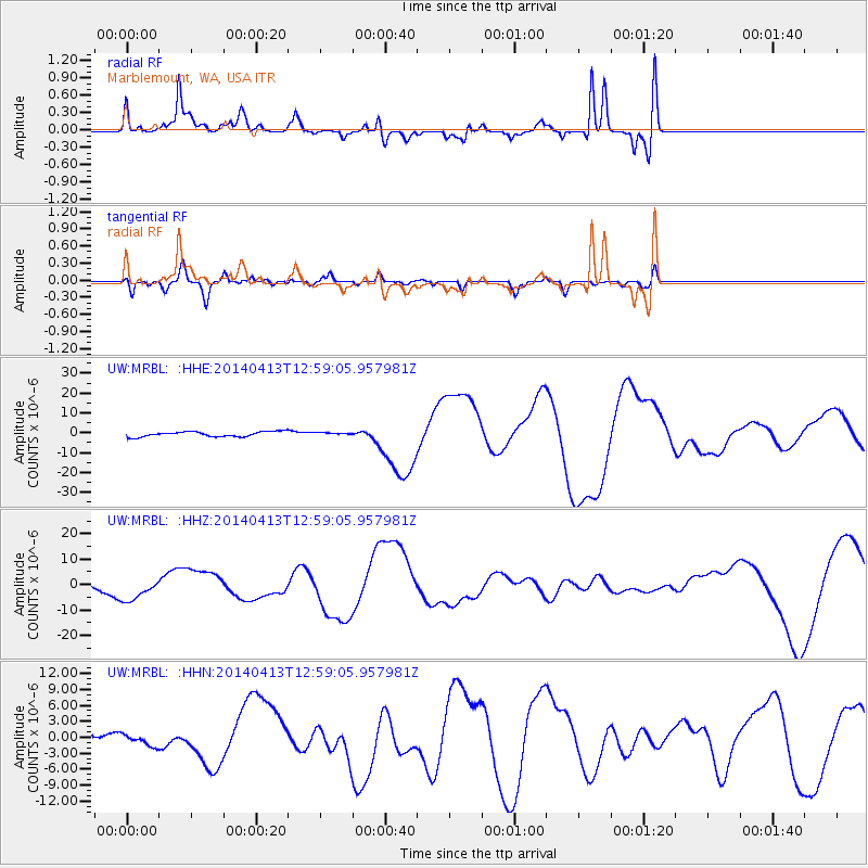
MRBL Marblemount, WA, USA - Earthquake Result Viewer
*The percent match for this event was below the threshold and hence no stack was calculated.
| Earthquake location: |
Solomon Islands |
| Earthquake latitude/longitude: |
-11.5/162.3 |
| Earthquake time(UTC): |
2014/04/13 (103) 12:46:43 GMT |
| Earthquake Depth: |
31 km |
| Earthquake Magnitude: |
5.7 MB |
| Earthquake Catalog/Contributor: |
NEIC PDE/NEIC COMCAT |
|
| Network: |
UW Pacific Northwest Regional Seismic Network |
| Station: |
MRBL Marblemount, WA, USA |
| Lat/Lon: |
48.52 N/121.48 W |
| Elevation: |
75 m |
|
| Distance: |
89.5 deg |
| Az: |
40.216 deg |
| Baz: |
252.178 deg |
| Ray Param: |
$rayparam |
*The percent match for this event was below the threshold and hence was not used in the summary stack. |
|
| Radial Match: |
58.1935 % |
| Radial Bump: |
400 |
| Transverse Match: |
49.040703 % |
| Transverse Bump: |
400 |
| SOD ConfigId: |
626651 |
| Insert Time: |
2014-04-27 13:21:04.514 +0000 |
| GWidth: |
2.5 |
| Max Bumps: |
400 |
| Tol: |
0.001 |
|
Signal To Noise
| Channel | StoN | STA | LTA |
| UW:MRBL: :HHZ:20140413T12:59:05.957981Z | 2.3759372 | 4.4715202E-6 | 1.8820027E-6 |
| UW:MRBL: :HHN:20140413T12:59:05.957981Z | 1.8242913 | 1.0394816E-6 | 5.698002E-7 |
| UW:MRBL: :HHE:20140413T12:59:05.957981Z | 0.52127874 | 6.626015E-7 | 1.2711079E-6 |
| Arrivals |
| Ps | |
| PpPs | |
| PsPs/PpSs | |


