You are here: Home > Network List > US - United States National Seismic Network Stations List
> Station EGMT Eagleton, Montana, USA > Earthquake Result Viewer
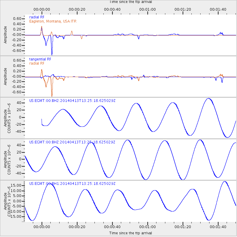
EGMT Eagleton, Montana, USA - Earthquake Result Viewer
*The percent match for this event was below the threshold and hence no stack was calculated.
| Earthquake location: |
Solomon Islands |
| Earthquake latitude/longitude: |
-11.2/161.9 |
| Earthquake time(UTC): |
2014/04/13 (103) 13:12:21 GMT |
| Earthquake Depth: |
35 km |
| Earthquake Magnitude: |
5.6 MB |
| Earthquake Catalog/Contributor: |
NEIC PDE/NEIC COMCAT |
|
| Network: |
US United States National Seismic Network |
| Station: |
EGMT Eagleton, Montana, USA |
| Lat/Lon: |
48.02 N/109.75 W |
| Elevation: |
1055 m |
|
| Distance: |
97.1 deg |
| Az: |
42.55 deg |
| Baz: |
261.244 deg |
| Ray Param: |
$rayparam |
*The percent match for this event was below the threshold and hence was not used in the summary stack. |
|
| Radial Match: |
96.333336 % |
| Radial Bump: |
283 |
| Transverse Match: |
78.752014 % |
| Transverse Bump: |
400 |
| SOD ConfigId: |
626651 |
| Insert Time: |
2014-04-27 13:31:24.032 +0000 |
| GWidth: |
2.5 |
| Max Bumps: |
400 |
| Tol: |
0.001 |
|
Signal To Noise
| Channel | StoN | STA | LTA |
| US:EGMT:00:BHZ:20140413T13:25:18.625029Z | 0.9146813 | 1.6971902E-5 | 1.8554989E-5 |
| US:EGMT:00:BH1:20140413T13:25:18.625029Z | 1.2250947 | 1.3465272E-5 | 1.0991209E-5 |
| US:EGMT:00:BH2:20140413T13:25:18.625029Z | 1.7810096 | 3.0875333E-5 | 1.733586E-5 |
| Arrivals |
| Ps | |
| PpPs | |
| PsPs/PpSs | |


