You are here: Home > Network List > TA - USArray Transportable Network (new EarthScope stations) Stations List
> Station J04D Umpqua National Forest, Toketee, OR, USA > Earthquake Result Viewer
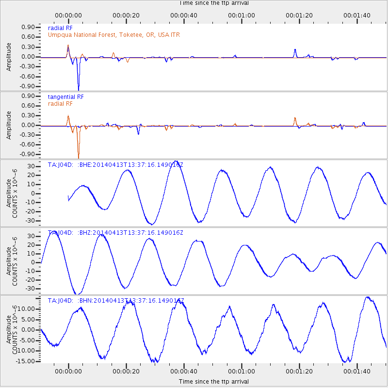
J04D Umpqua National Forest, Toketee, OR, USA - Earthquake Result Viewer
*The percent match for this event was below the threshold and hence no stack was calculated.
| Earthquake location: |
Solomon Islands |
| Earthquake latitude/longitude: |
-11.1/162.0 |
| Earthquake time(UTC): |
2014/04/13 (103) 13:25:03 GMT |
| Earthquake Depth: |
35 km |
| Earthquake Magnitude: |
6.6 MWW, 6.7 MWC |
| Earthquake Catalog/Contributor: |
NEIC PDE/NEIC COMCAT |
|
| Network: |
TA USArray Transportable Network (new EarthScope stations) |
| Station: |
J04D Umpqua National Forest, Toketee, OR, USA |
| Lat/Lon: |
43.24 N/122.11 W |
| Elevation: |
1948 m |
|
| Distance: |
87.5 deg |
| Az: |
45.179 deg |
| Baz: |
252.29 deg |
| Ray Param: |
$rayparam |
*The percent match for this event was below the threshold and hence was not used in the summary stack. |
|
| Radial Match: |
98.28564 % |
| Radial Bump: |
201 |
| Transverse Match: |
78.13606 % |
| Transverse Bump: |
282 |
| SOD ConfigId: |
626651 |
| Insert Time: |
2014-04-27 13:41:27.241 +0000 |
| GWidth: |
2.5 |
| Max Bumps: |
400 |
| Tol: |
0.001 |
|
Signal To Noise
| Channel | StoN | STA | LTA |
| TA:J04D: :BHZ:20140413T13:37:16.149016Z | 1.3365396 | 2.8068083E-5 | 2.1000564E-5 |
| TA:J04D: :BHN:20140413T13:37:16.149016Z | 3.6668315 | 8.123184E-6 | 2.215314E-6 |
| TA:J04D: :BHE:20140413T13:37:16.149016Z | 1.813752 | 2.3130111E-5 | 1.275263E-5 |
| Arrivals |
| Ps | |
| PpPs | |
| PsPs/PpSs | |


