KDAK Kodiak Island, Alaska, USA - Earthquake Result Viewer
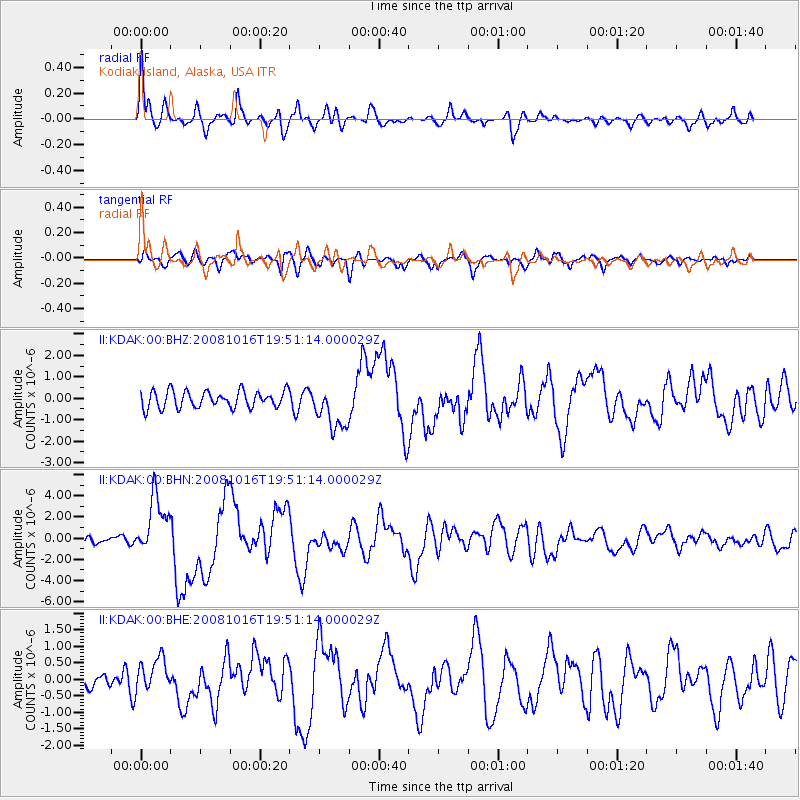
Earthquake location: Near Coast Of Chiapas, Mexico
Earthquake latitude/longitude: 14.4/-92.4
Earthquake time(UTC): 2008/10/16 (290) 19:41:25 GMT
Earthquake Depth: 24 km
Earthquake Magnitude: 6.1 MB, 6.6 MS, 6.7 MW, 6.6 MW
Earthquake Catalog/Contributor: WHDF/NEIC
Network: II Global Seismograph Network (GSN - IRIS/IDA)
Station: KDAK Kodiak Island, Alaska, USA
Lat/Lon: 57.78 N/152.58 W
Elevation: 152 m
Distance: 62.2 deg
Az: 328.282 deg
Baz: 108.032 deg
Ray Param: 0.06036862
Estimated Moho Depth: 33.0 km
Estimated Crust Vp/Vs: 1.72
Assumed Crust Vp: 6.134 km/s
Estimated Crust Vs: 3.571 km/s
Estimated Crust Poisson's Ratio: 0.24
Radial Match: 88.36354 %
Radial Bump: 400
Transverse Match: 80.22095 %
Transverse Bump: 400
SOD ConfigId: 2556
Insert Time: 2010-03-01 21:00:58.471 +0000
GWidth: 2.5
Max Bumps: 400
Tol: 0.001

Signal To Noise

ChannelStoNSTALTA
II:KDAK:00:BHN:20081016T19:51:14.000029Z5.90299222.7592223E-64.6742775E-7
II:KDAK:00:BHE:20081016T19:51:14.000029Z1.52919695.068064E-73.3141995E-7
II:KDAK:00:BHZ:20081016T19:51:14.000029Z2.6778531.0479574E-63.9134238E-7
Arrivals
Ps4.0 SECOND
PpPs14 SECOND
PsPs/PpSs18 SECOND