KDAK Kodiak Island, Alaska, USA - Earthquake Result Viewer
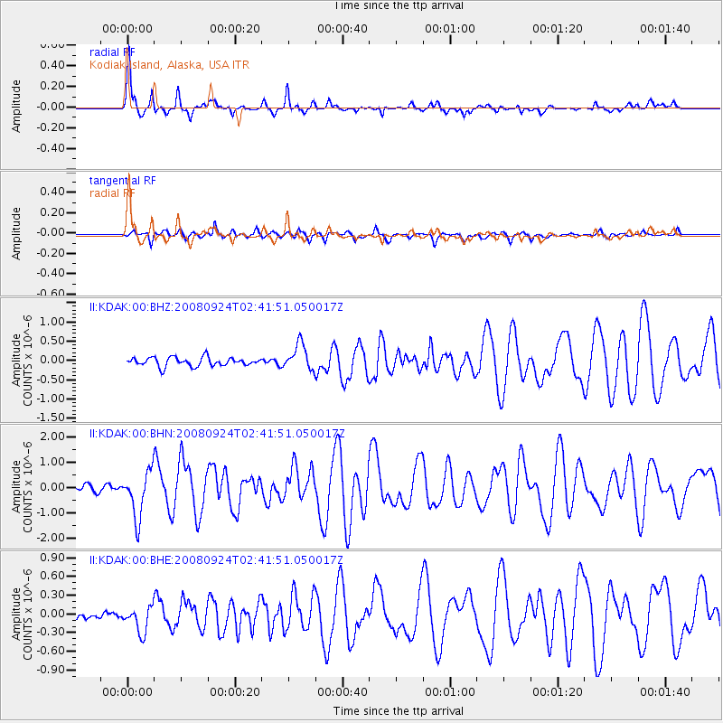
Earthquake location: Off Coast Of Jalisco, Mexico
Earthquake latitude/longitude: 17.6/-105.5
Earthquake time(UTC): 2008/09/24 (268) 02:33:05 GMT
Earthquake Depth: 10 km
Earthquake Magnitude: 5.7 MB, 6.2 MS, 6.4 MW, 6.4 MW
Earthquake Catalog/Contributor: WHDF/NEIC
Network: II Global Seismograph Network (GSN - IRIS/IDA)
Station: KDAK Kodiak Island, Alaska, USA
Lat/Lon: 57.78 N/152.58 W
Elevation: 152 m
Distance: 53.0 deg
Az: 330.58 deg
Baz: 119.01 deg
Ray Param: 0.06639125
Estimated Moho Depth: 36.0 km
Estimated Crust Vp/Vs: 1.73
Assumed Crust Vp: 6.134 km/s
Estimated Crust Vs: 3.556 km/s
Estimated Crust Poisson's Ratio: 0.25
Radial Match: 94.69723 %
Radial Bump: 368
Transverse Match: 83.68915 %
Transverse Bump: 400
SOD ConfigId: 2560
Insert Time: 2010-03-01 21:01:06.245 +0000
GWidth: 2.5
Max Bumps: 400
Tol: 0.001

Signal To Noise

ChannelStoNSTALTA
II:KDAK:00:BHN:20080924T02:41:51.050017Z7.82353359.270996E-71.1850139E-7
II:KDAK:00:BHE:20080924T02:41:51.050017Z2.6235942.067773E-77.8814516E-8
II:KDAK:00:BHZ:20080924T02:41:51.050017Z3.01008273.3849813E-71.1245476E-7
Arrivals
Ps4.5 SECOND
PpPs15 SECOND
PsPs/PpSs20 SECOND