KDAK Kodiak Island, Alaska, USA - Earthquake Result Viewer
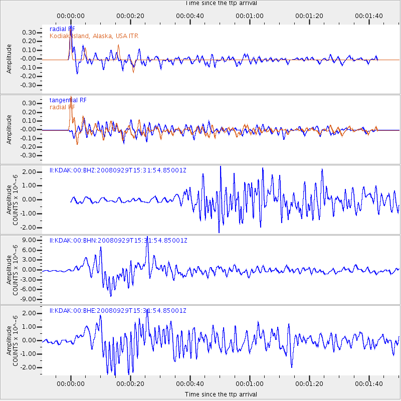
Earthquake location: Kermadec Islands, New Zealand
Earthquake latitude/longitude: -29.8/-177.7
Earthquake time(UTC): 2008/09/29 (273) 15:19:31 GMT
Earthquake Depth: 36 km
Earthquake Magnitude: 6.5 MB, 6.7 MS, 7.0 MW, 7.0 MW
Earthquake Catalog/Contributor: WHDF/NEIC
Network: II Global Seismograph Network (GSN - IRIS/IDA)
Station: KDAK Kodiak Island, Alaska, USA
Lat/Lon: 57.78 N/152.58 W
Elevation: 152 m
Distance: 89.7 deg
Az: 13.135 deg
Baz: 201.646 deg
Ray Param: 0.041719954
Estimated Moho Depth: 29.75 km
Estimated Crust Vp/Vs: 1.83
Assumed Crust Vp: 6.134 km/s
Estimated Crust Vs: 3.352 km/s
Estimated Crust Poisson's Ratio: 0.29
Radial Match: 95.26903 %
Radial Bump: 400
Transverse Match: 90.93272 %
Transverse Bump: 400
SOD ConfigId: 2560
Insert Time: 2010-03-01 21:01:09.027 +0000
GWidth: 2.5
Max Bumps: 400
Tol: 0.001

Signal To Noise

ChannelStoNSTALTA
II:KDAK:00:BHN:20080929T15:31:54.85001Z9.9352661.3622581E-61.371134E-7
II:KDAK:00:BHE:20080929T15:31:54.85001Z3.65143943.7938395E-71.03899836E-7
II:KDAK:00:BHZ:20080929T15:31:54.85001Z0.86967181.09119E-71.2547147E-7
Arrivals
Ps4.1 SECOND
PpPs13 SECOND
PsPs/PpSs18 SECOND