You are here: Home > Network List > AK - Alaska Regional Network Stations List
> Station MDM Murphy Dome > Earthquake Result Viewer
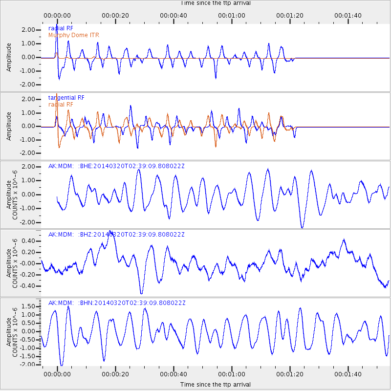
MDM Murphy Dome - Earthquake Result Viewer
*The percent match for this event was below the threshold and hence no stack was calculated.
| Earthquake location: |
South Of Tonga Islands |
| Earthquake latitude/longitude: |
-24.2/-175.0 |
| Earthquake time(UTC): |
2014/03/20 (079) 02:26:37 GMT |
| Earthquake Depth: |
22 km |
| Earthquake Magnitude: |
6.7 MB |
| Earthquake Catalog/Contributor: |
NEIC PDE/NEIC COMCAT |
|
| Network: |
AK Alaska Regional Network |
| Station: |
MDM Murphy Dome |
| Lat/Lon: |
64.96 N/148.23 W |
| Elevation: |
634 m |
|
| Distance: |
91.3 deg |
| Az: |
11.073 deg |
| Baz: |
204.333 deg |
| Ray Param: |
$rayparam |
*The percent match for this event was below the threshold and hence was not used in the summary stack. |
|
| Radial Match: |
38.304653 % |
| Radial Bump: |
400 |
| Transverse Match: |
52.985302 % |
| Transverse Bump: |
348 |
| SOD ConfigId: |
626651 |
| Insert Time: |
2014-04-29 00:17:58.554 +0000 |
| GWidth: |
2.5 |
| Max Bumps: |
400 |
| Tol: |
0.001 |
|
Signal To Noise
| Channel | StoN | STA | LTA |
| AK:MDM: :BHZ:20140320T02:39:09.808022Z | 0.34204143 | 1.00666234E-7 | 2.9431007E-7 |
| AK:MDM: :BHN:20140320T02:39:09.808022Z | 2.0826304 | 1.2789561E-6 | 6.1410617E-7 |
| AK:MDM: :BHE:20140320T02:39:09.808022Z | 1.4290065 | 8.200129E-7 | 5.738343E-7 |
| Arrivals |
| Ps | |
| PpPs | |
| PsPs/PpSs | |


