You are here: Home > Network List > GT - Global Telemetered Seismograph Network (USAF/USGS) Stations List
> Station LPAZ La Paz , Bolivia > Earthquake Result Viewer
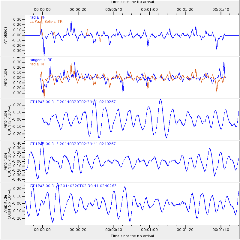
LPAZ La Paz , Bolivia - Earthquake Result Viewer
*The percent match for this event was below the threshold and hence no stack was calculated.
| Earthquake location: |
South Of Tonga Islands |
| Earthquake latitude/longitude: |
-24.2/-175.0 |
| Earthquake time(UTC): |
2014/03/20 (079) 02:26:37 GMT |
| Earthquake Depth: |
22 km |
| Earthquake Magnitude: |
6.7 MB |
| Earthquake Catalog/Contributor: |
NEIC PDE/NEIC COMCAT |
|
| Network: |
GT Global Telemetered Seismograph Network (USAF/USGS) |
| Station: |
LPAZ La Paz , Bolivia |
| Lat/Lon: |
16.17 S/68.08 W |
| Elevation: |
4817 m |
|
| Distance: |
98.2 deg |
| Az: |
111.772 deg |
| Baz: |
241.941 deg |
| Ray Param: |
$rayparam |
*The percent match for this event was below the threshold and hence was not used in the summary stack. |
|
| Radial Match: |
63.48077 % |
| Radial Bump: |
400 |
| Transverse Match: |
59.42307 % |
| Transverse Bump: |
400 |
| SOD ConfigId: |
626651 |
| Insert Time: |
2014-04-29 00:23:20.697 +0000 |
| GWidth: |
2.5 |
| Max Bumps: |
400 |
| Tol: |
0.001 |
|
Signal To Noise
| Channel | StoN | STA | LTA |
| GT:LPAZ:00:BHZ:20140320T02:39:41.024026Z | 1.9979694 | 2.463092E-7 | 1.2327978E-7 |
| GT:LPAZ:00:BHN:20140320T02:39:41.024026Z | 1.3649955 | 9.222295E-8 | 6.756282E-8 |
| GT:LPAZ:00:BHE:20140320T02:39:41.024026Z | 2.7147758 | 1.7466412E-7 | 6.433832E-8 |
| Arrivals |
| Ps | |
| PpPs | |
| PsPs/PpSs | |


