You are here: Home > Network List > TA - USArray Transportable Network (new EarthScope stations) Stations List
> Station N23A Red Feather Lakes, CO, USA > Earthquake Result Viewer
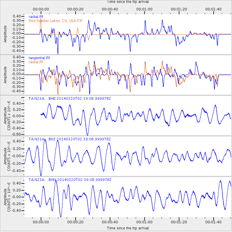
N23A Red Feather Lakes, CO, USA - Earthquake Result Viewer
*The percent match for this event was below the threshold and hence no stack was calculated.
| Earthquake location: |
South Of Tonga Islands |
| Earthquake latitude/longitude: |
-24.2/-175.0 |
| Earthquake time(UTC): |
2014/03/20 (079) 02:26:37 GMT |
| Earthquake Depth: |
22 km |
| Earthquake Magnitude: |
6.7 MB |
| Earthquake Catalog/Contributor: |
NEIC PDE/NEIC COMCAT |
|
| Network: |
TA USArray Transportable Network (new EarthScope stations) |
| Station: |
N23A Red Feather Lakes, CO, USA |
| Lat/Lon: |
40.89 N/105.94 W |
| Elevation: |
2458 m |
|
| Distance: |
91.1 deg |
| Az: |
45.1 deg |
| Baz: |
238.562 deg |
| Ray Param: |
$rayparam |
*The percent match for this event was below the threshold and hence was not used in the summary stack. |
|
| Radial Match: |
44.727974 % |
| Radial Bump: |
400 |
| Transverse Match: |
54.48987 % |
| Transverse Bump: |
400 |
| SOD ConfigId: |
626651 |
| Insert Time: |
2014-04-29 00:28:25.385 +0000 |
| GWidth: |
2.5 |
| Max Bumps: |
400 |
| Tol: |
0.001 |
|
Signal To Noise
| Channel | StoN | STA | LTA |
| TA:N23A: :BHZ:20140320T02:39:08.999978Z | 1.9433129 | 3.2407573E-7 | 1.6676456E-7 |
| TA:N23A: :BHN:20140320T02:39:08.999978Z | 1.0297308 | 2.1838129E-7 | 2.1207609E-7 |
| TA:N23A: :BHE:20140320T02:39:08.999978Z | 1.0748839 | 2.0633269E-7 | 1.9195811E-7 |
| Arrivals |
| Ps | |
| PpPs | |
| PsPs/PpSs | |


