You are here: Home > Network List > TA - USArray Transportable Network (new EarthScope stations) Stations List
> Station G03D McMinnville, OR, USA > Earthquake Result Viewer
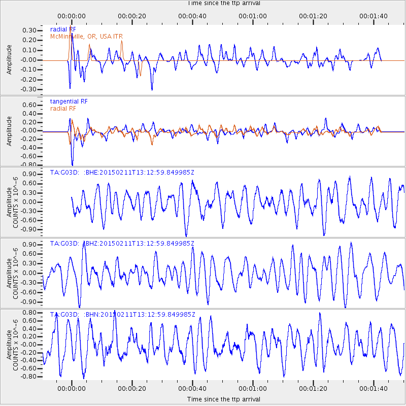
G03D McMinnville, OR, USA - Earthquake Result Viewer
*The percent match for this event was below the threshold and hence no stack was calculated.
| Earthquake location: |
Jujuy Province, Argentina |
| Earthquake latitude/longitude: |
-23.5/-66.7 |
| Earthquake time(UTC): |
2015/02/11 (042) 13:01:15 GMT |
| Earthquake Depth: |
201 km |
| Earthquake Magnitude: |
5.5 MWW |
| Earthquake Catalog/Contributor: |
NEIC PDE/NEIC COMCAT |
|
| Network: |
TA USArray Transportable Network (new EarthScope stations) |
| Station: |
G03D McMinnville, OR, USA |
| Lat/Lon: |
45.21 N/123.26 W |
| Elevation: |
222 m |
|
| Distance: |
85.6 deg |
| Az: |
323.734 deg |
| Baz: |
129.826 deg |
| Ray Param: |
$rayparam |
*The percent match for this event was below the threshold and hence was not used in the summary stack. |
|
| Radial Match: |
51.06488 % |
| Radial Bump: |
400 |
| Transverse Match: |
64.753685 % |
| Transverse Bump: |
400 |
| SOD ConfigId: |
7019011 |
| Insert Time: |
2019-04-16 18:00:46.159 +0000 |
| GWidth: |
2.5 |
| Max Bumps: |
400 |
| Tol: |
0.001 |
|
Signal To Noise
| Channel | StoN | STA | LTA |
| TA:G03D: :BHZ:20150211T13:12:59.849985Z | 1.7213618 | 6.0290506E-7 | 3.502489E-7 |
| TA:G03D: :BHN:20150211T13:12:59.849985Z | 1.3372285 | 4.8013237E-7 | 3.5905035E-7 |
| TA:G03D: :BHE:20150211T13:12:59.849985Z | 0.69026715 | 2.3552934E-7 | 3.4121476E-7 |
| Arrivals |
| Ps | |
| PpPs | |
| PsPs/PpSs | |


