You are here: Home > Network List > TA - USArray Transportable Network (new EarthScope stations) Stations List
> Station K48A Perry, MI, USA > Earthquake Result Viewer
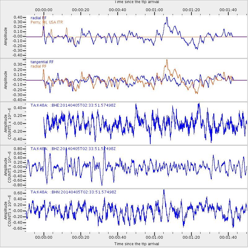
K48A Perry, MI, USA - Earthquake Result Viewer
*The percent match for this event was below the threshold and hence no stack was calculated.
| Earthquake location: |
Near Coast Of Central Chile |
| Earthquake latitude/longitude: |
-32.8/-71.6 |
| Earthquake time(UTC): |
2014/04/05 (095) 02:22:38 GMT |
| Earthquake Depth: |
40 km |
| Earthquake Magnitude: |
5.6 MWC, 5.6 MWC |
| Earthquake Catalog/Contributor: |
NEIC PDE/NEIC COMCAT |
|
| Network: |
TA USArray Transportable Network (new EarthScope stations) |
| Station: |
K48A Perry, MI, USA |
| Lat/Lon: |
42.80 N/84.12 W |
| Elevation: |
273 m |
|
| Distance: |
76.1 deg |
| Az: |
350.526 deg |
| Baz: |
169.143 deg |
| Ray Param: |
$rayparam |
*The percent match for this event was below the threshold and hence was not used in the summary stack. |
|
| Radial Match: |
53.60486 % |
| Radial Bump: |
400 |
| Transverse Match: |
53.078247 % |
| Transverse Bump: |
400 |
| SOD ConfigId: |
626651 |
| Insert Time: |
2014-05-02 00:32:28.396 +0000 |
| GWidth: |
2.5 |
| Max Bumps: |
400 |
| Tol: |
0.001 |
|
Signal To Noise
| Channel | StoN | STA | LTA |
| TA:K48A: :BHZ:20140405T02:33:51.57498Z | 2.0563056 | 4.187875E-7 | 2.0366012E-7 |
| TA:K48A: :BHN:20140405T02:33:51.57498Z | 1.0893949 | 1.9360967E-7 | 1.777222E-7 |
| TA:K48A: :BHE:20140405T02:33:51.57498Z | 0.9733903 | 1.4485394E-7 | 1.4881384E-7 |
| Arrivals |
| Ps | |
| PpPs | |
| PsPs/PpSs | |


