FOXP Brandywine, West Virginia USA - Earthquake Result Viewer
Earthquake location: Jujuy Province, Argentina
Earthquake latitude/longitude: -23.1/-66.7
Earthquake time(UTC): 2015/02/11 (042) 18:57:22 GMT
Earthquake Depth: 223 km
Earthquake Magnitude: 6.7 MWW, 6.7 MWC, 6.7 MWB, 6.9 MI
Earthquake Catalog/Contributor: NEIC PDE/NEIC COMCAT
Network: 7A Mid-Atlantic Geophysical Integrative Collaboration
Station: FOXP Brandywine, West Virginia USA
Lat/Lon: 38.63 N/79.25 W
Elevation: 485 m
Distance: 62.5 deg
Az: 348.937 deg
Baz: 166.963 deg
Ray Param: 0.059474375
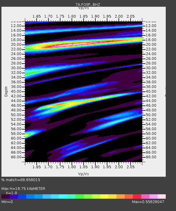
Estimated Moho Depth: 19.75 km
Estimated Crust Vp/Vs: 1.80
Assumed Crust Vp: 6.159 km/s
Estimated Crust Vs: 3.421 km/s
Estimated Crust Poisson's Ratio: 0.28
Radial Match: 89.959015 %
Radial Bump: 400
Transverse Match: 72.3781 %
Transverse Bump: 400
SOD ConfigId: 7019011
Insert Time: 2019-04-16 18:06:30.470 +0000
GWidth: 2.5
Max Bumps: 400
Tol: 0.001

Signal To Noise

ChannelStoNSTALTA
7A:FOXP: :BHZ:20150211T19:06:51.384978Z13.2735053.838552E-62.8918905E-7
7A:FOXP: :BHN:20150211T19:06:51.384978Z6.3692751.7008286E-62.6703646E-7
7A:FOXP: :BHE:20150211T19:06:51.384978Z2.41324333.8144694E-71.5806401E-7
Arrivals
Ps2.7 SECOND
PpPs8.6 SECOND
PsPs/PpSs11 SECOND