You are here: Home > Network List > TA - USArray Transportable Network (new EarthScope stations) Stations List
> Station O48A Farmland, IN, USA > Earthquake Result Viewer
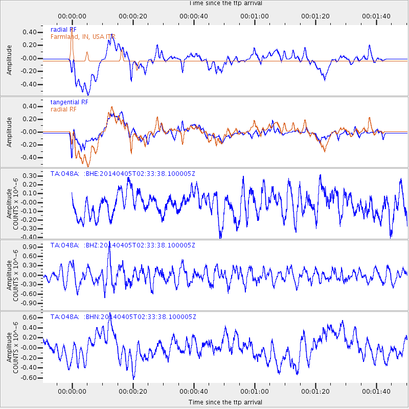
O48A Farmland, IN, USA - Earthquake Result Viewer
*The percent match for this event was below the threshold and hence no stack was calculated.
| Earthquake location: |
Near Coast Of Central Chile |
| Earthquake latitude/longitude: |
-32.8/-71.6 |
| Earthquake time(UTC): |
2014/04/05 (095) 02:22:38 GMT |
| Earthquake Depth: |
40 km |
| Earthquake Magnitude: |
5.6 MWC, 5.6 MWC |
| Earthquake Catalog/Contributor: |
NEIC PDE/NEIC COMCAT |
|
| Network: |
TA USArray Transportable Network (new EarthScope stations) |
| Station: |
O48A Farmland, IN, USA |
| Lat/Lon: |
40.26 N/85.16 W |
| Elevation: |
300 m |
|
| Distance: |
73.8 deg |
| Az: |
349.217 deg |
| Baz: |
168.118 deg |
| Ray Param: |
$rayparam |
*The percent match for this event was below the threshold and hence was not used in the summary stack. |
|
| Radial Match: |
41.940506 % |
| Radial Bump: |
400 |
| Transverse Match: |
38.520035 % |
| Transverse Bump: |
400 |
| SOD ConfigId: |
626651 |
| Insert Time: |
2014-05-02 00:34:55.976 +0000 |
| GWidth: |
2.5 |
| Max Bumps: |
400 |
| Tol: |
0.001 |
|
Signal To Noise
| Channel | StoN | STA | LTA |
| TA:O48A: :BHZ:20140405T02:33:38.100005Z | 2.4876204 | 3.185301E-7 | 1.2804612E-7 |
| TA:O48A: :BHN:20140405T02:33:38.100005Z | 1.0169774 | 2.1872864E-7 | 2.150772E-7 |
| TA:O48A: :BHE:20140405T02:33:38.100005Z | 0.6011254 | 8.166813E-8 | 1.3585871E-7 |
| Arrivals |
| Ps | |
| PpPs | |
| PsPs/PpSs | |


