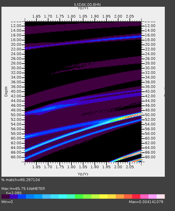
KDAK Kodiak Island, Alaska, USA - Earthquake Result Viewer
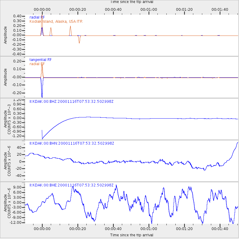
Earthquake location: New Ireland Region, P.N.G.
Earthquake latitude/longitude: -5.2/153.1
Earthquake time(UTC): 2000/11/16 (321) 07:42:16 GMT
Earthquake Depth: 30 km
Earthquake Magnitude: 6.2 MB, 7.8 MS, 7.6 MW, 7.3 ME
Earthquake Catalog/Contributor: WHDF/NEIC
Network: II Global Seismograph Network (GSN - IRIS/IDA)
Station: KDAK Kodiak Island, Alaska, USA
Lat/Lon: 57.78 N/152.58 W
Elevation: 152 m
Distance: 76.4 deg
Az: 26.59 deg
Baz: 236.319 deg
Ray Param: 0.05096212
Estimated Moho Depth: 65.75 km
Estimated Crust Vp/Vs: 2.10
Assumed Crust Vp: 6.134 km/s
Estimated Crust Vs: 2.928 km/s
Estimated Crust Poisson's Ratio: 0.35
Radial Match: 98.297104 %
Radial Bump: 38
Transverse Match: 99.81392 %
Transverse Bump: 31
SOD ConfigId: 3744
Insert Time: 2010-03-01 21:07:35.393 +0000
GWidth: 2.5
Max Bumps: 400
Tol: 0.001

Signal To Noise

ChannelStoNSTALTA
II:KDAK:00:BHN:20001116T07:53:32.502998Z0.908447278.3904546E-59.23604E-5
II:KDAK:00:BHE:20001116T07:53:32.502998Z0.5624542.0532823E-63.6505783E-6
II:KDAK:00:BHZ:20001116T07:53:32.502998Z0.94452774.0489357E-44.2867305E-4
Arrivals
Ps12 SECOND
PpPs32 SECOND
PsPs/PpSs44 SECOND