MUR Murrieta - Earthquake Result Viewer
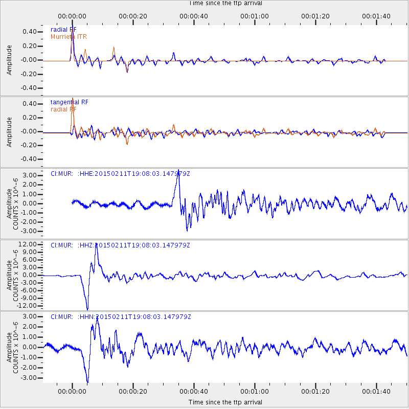
Earthquake location: Jujuy Province, Argentina
Earthquake latitude/longitude: -23.1/-66.7
Earthquake time(UTC): 2015/02/11 (042) 18:57:22 GMT
Earthquake Depth: 223 km
Earthquake Magnitude: 6.7 MWW, 6.7 MWC, 6.7 MWB, 6.9 MI
Earthquake Catalog/Contributor: NEIC PDE/NEIC COMCAT
Network: CI Caltech Regional Seismic Network
Station: MUR Murrieta
Lat/Lon: 33.60 N/117.20 W
Elevation: 562 m
Distance: 74.1 deg
Az: 317.96 deg
Baz: 132.377 deg
Ray Param: 0.05195026
Estimated Moho Depth: 27.25 km
Estimated Crust Vp/Vs: 2.10
Assumed Crust Vp: 6.264 km/s
Estimated Crust Vs: 2.986 km/s
Estimated Crust Poisson's Ratio: 0.35
Radial Match: 95.99608 %
Radial Bump: 303
Transverse Match: 79.674995 %
Transverse Bump: 400
SOD ConfigId: 7019011
Insert Time: 2019-04-16 18:08:21.550 +0000
GWidth: 2.5
Max Bumps: 400
Tol: 0.001

Signal To Noise

ChannelStoNSTALTA
CI:MUR: :HHZ:20150211T19:08:03.147979Z23.4882134.198265E-61.7873921E-7
CI:MUR: :HHN:20150211T19:08:03.147979Z3.31740021.0724176E-63.2327048E-7
CI:MUR: :HHE:20150211T19:08:03.147979Z4.69064241.1065164E-62.3589868E-7
Arrivals
Ps4.9 SECOND
PpPs13 SECOND
PsPs/PpSs18 SECOND