You are here: Home > Network List > AZ - ANZA Regional Network Stations List
> Station SMER AZ.SMER > Earthquake Result Viewer
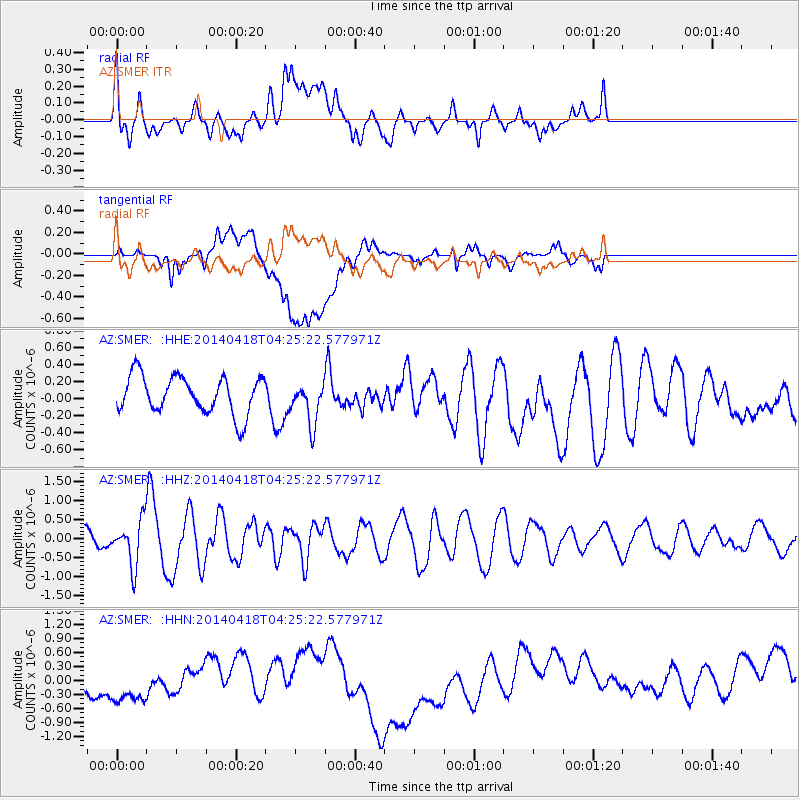
SMER AZ.SMER - Earthquake Result Viewer
*The percent match for this event was below the threshold and hence no stack was calculated.
| Earthquake location: |
Santa Cruz Islands Region |
| Earthquake latitude/longitude: |
-11.2/164.8 |
| Earthquake time(UTC): |
2014/04/18 (108) 04:13:12 GMT |
| Earthquake Depth: |
10 km |
| Earthquake Magnitude: |
6.0 MB |
| Earthquake Catalog/Contributor: |
NEIC PDE/NEIC COMCAT |
|
| Network: |
AZ ANZA Regional Network |
| Station: |
SMER AZ.SMER |
| Lat/Lon: |
33.46 N/117.17 W |
| Elevation: |
355 m |
|
| Distance: |
86.3 deg |
| Az: |
55.036 deg |
| Baz: |
254.156 deg |
| Ray Param: |
$rayparam |
*The percent match for this event was below the threshold and hence was not used in the summary stack. |
|
| Radial Match: |
51.73509 % |
| Radial Bump: |
400 |
| Transverse Match: |
39.649837 % |
| Transverse Bump: |
400 |
| SOD ConfigId: |
626651 |
| Insert Time: |
2014-05-02 04:33:53.197 +0000 |
| GWidth: |
2.5 |
| Max Bumps: |
400 |
| Tol: |
0.001 |
|
Signal To Noise
| Channel | StoN | STA | LTA |
| AZ:SMER: :HHZ:20140418T04:25:22.577971Z | 2.3932197 | 5.893994E-7 | 2.4627883E-7 |
| AZ:SMER: :HHN:20140418T04:25:22.577971Z | 1.5141512 | 6.800013E-7 | 4.4909734E-7 |
| AZ:SMER: :HHE:20140418T04:25:22.577971Z | 1.1036224 | 2.4283156E-7 | 2.200314E-7 |
| Arrivals |
| Ps | |
| PpPs | |
| PsPs/PpSs | |


