KDAK Kodiak Island, Alaska, USA - Earthquake Result Viewer
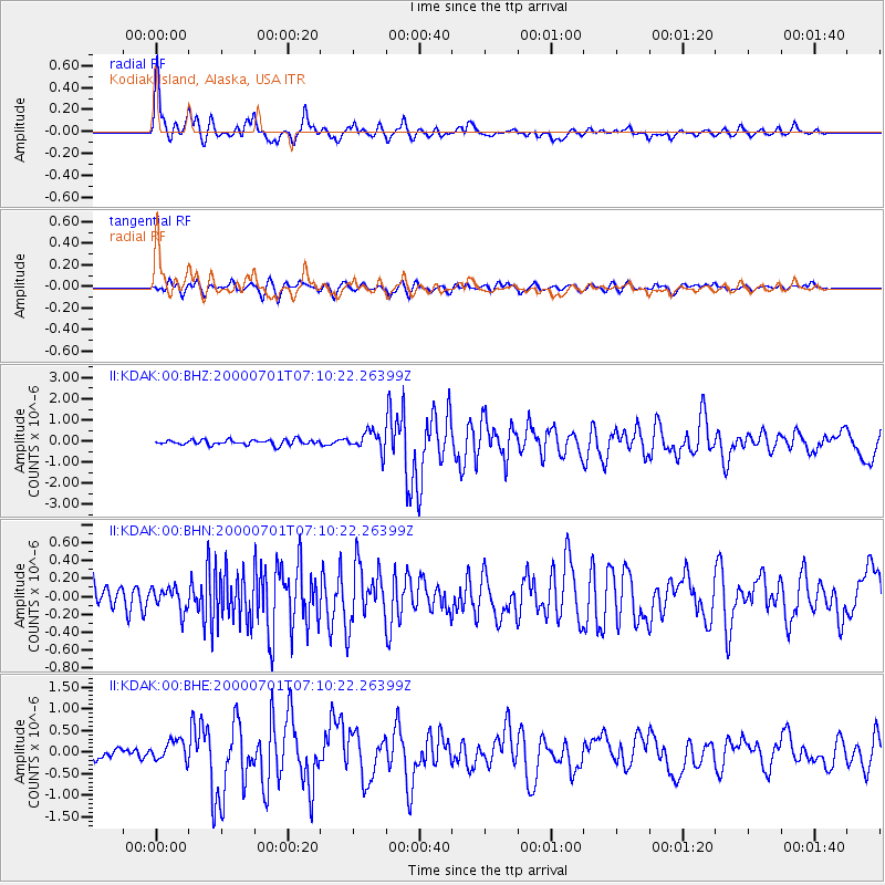
Earthquake location: Near S. Coast Of Honshu, Japan
Earthquake latitude/longitude: 34.2/139.1
Earthquake time(UTC): 2000/07/01 (183) 07:01:55 GMT
Earthquake Depth: 10 km
Earthquake Magnitude: 6.0 MB, 6.1 MS, 6.2 MW, 6.2 MW
Earthquake Catalog/Contributor: WHDF/NEIC
Network: II Global Seismograph Network (GSN - IRIS/IDA)
Station: KDAK Kodiak Island, Alaska, USA
Lat/Lon: 57.78 N/152.58 W
Elevation: 152 m
Distance: 50.4 deg
Az: 40.209 deg
Baz: 273.049 deg
Ray Param: 0.06805876
Estimated Moho Depth: 31.25 km
Estimated Crust Vp/Vs: 2.10
Assumed Crust Vp: 6.134 km/s
Estimated Crust Vs: 2.924 km/s
Estimated Crust Poisson's Ratio: 0.35
Radial Match: 92.97838 %
Radial Bump: 379
Transverse Match: 78.20991 %
Transverse Bump: 400
SOD ConfigId: 3744
Insert Time: 2010-03-01 21:08:32.364 +0000
GWidth: 2.5
Max Bumps: 400
Tol: 0.001

Signal To Noise

ChannelStoNSTALTA
II:KDAK:00:BHN:20000701T07:10:22.26399Z1.20821261.2939546E-71.07096604E-7
II:KDAK:00:BHE:20000701T07:10:22.26399Z2.15872052.3888768E-71.106617E-7
II:KDAK:00:BHZ:20000701T07:10:22.26399Z3.93287424.6289944E-71.1770003E-7
Arrivals
Ps5.8 SECOND
PpPs15 SECOND
PsPs/PpSs21 SECOND