WUPA West Chester University of Pennsylvania - Earthquake Result Viewer
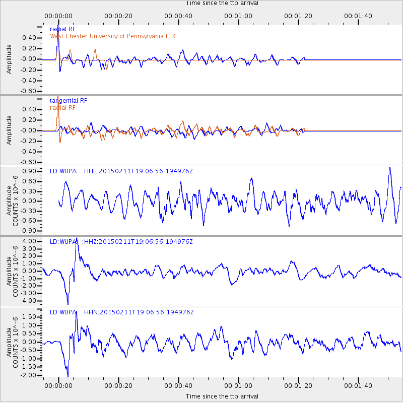
Earthquake location: Jujuy Province, Argentina
Earthquake latitude/longitude: -23.1/-66.7
Earthquake time(UTC): 2015/02/11 (042) 18:57:22 GMT
Earthquake Depth: 223 km
Earthquake Magnitude: 6.7 MWW, 6.7 MWC, 6.7 MWB, 6.9 MI
Earthquake Catalog/Contributor: NEIC PDE/NEIC COMCAT
Network: LD Lamont-Doherty Cooperative Seismographic Network
Station: WUPA West Chester University of Pennsylvania
Lat/Lon: 39.93 N/75.61 W
Elevation: 86 m
Distance: 63.3 deg
Az: 352.332 deg
Baz: 170.807 deg
Ray Param: 0.058997706
Estimated Moho Depth: 28.25 km
Estimated Crust Vp/Vs: 1.77
Assumed Crust Vp: 6.287 km/s
Estimated Crust Vs: 3.547 km/s
Estimated Crust Poisson's Ratio: 0.27
Radial Match: 81.40955 %
Radial Bump: 400
Transverse Match: 56.850555 %
Transverse Bump: 400
SOD ConfigId: 7019011
Insert Time: 2019-04-16 18:10:47.423 +0000
GWidth: 2.5
Max Bumps: 400
Tol: 0.001

Signal To Noise

ChannelStoNSTALTA
LD:WUPA: :HHZ:20150211T19:06:56.194976Z7.64637661.735771E-62.2700569E-7
LD:WUPA: :HHN:20150211T19:06:56.194976Z4.0927628.669441E-72.1182375E-7
LD:WUPA: :HHE:20150211T19:06:56.194976Z1.22965573.0341334E-72.4674657E-7
Arrivals
Ps3.6 SECOND
PpPs12 SECOND
PsPs/PpSs16 SECOND