You are here: Home > Network List > TA - USArray Transportable Network (new EarthScope stations) Stations List
> Station O03E Paynes Creek, CA, USA > Earthquake Result Viewer
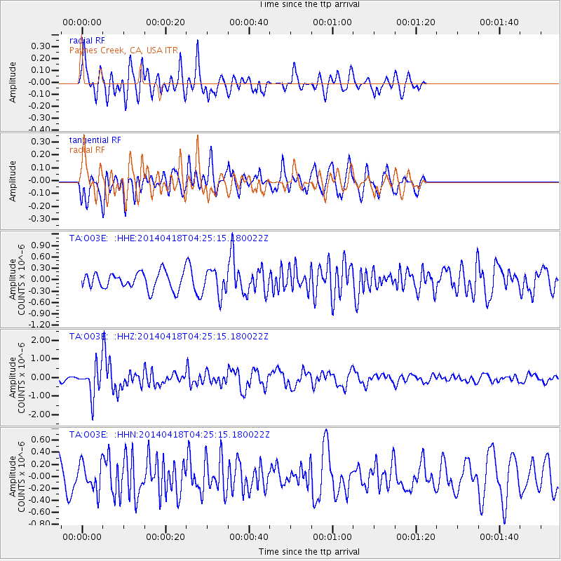
O03E Paynes Creek, CA, USA - Earthquake Result Viewer
*The percent match for this event was below the threshold and hence no stack was calculated.
| Earthquake location: |
Santa Cruz Islands Region |
| Earthquake latitude/longitude: |
-11.2/164.8 |
| Earthquake time(UTC): |
2014/04/18 (108) 04:13:12 GMT |
| Earthquake Depth: |
10 km |
| Earthquake Magnitude: |
6.0 MB |
| Earthquake Catalog/Contributor: |
NEIC PDE/NEIC COMCAT |
|
| Network: |
TA USArray Transportable Network (new EarthScope stations) |
| Station: |
O03E Paynes Creek, CA, USA |
| Lat/Lon: |
40.29 N/121.80 W |
| Elevation: |
967 m |
|
| Distance: |
84.8 deg |
| Az: |
47.391 deg |
| Baz: |
250.787 deg |
| Ray Param: |
$rayparam |
*The percent match for this event was below the threshold and hence was not used in the summary stack. |
|
| Radial Match: |
65.93042 % |
| Radial Bump: |
350 |
| Transverse Match: |
64.43904 % |
| Transverse Bump: |
400 |
| SOD ConfigId: |
626651 |
| Insert Time: |
2014-05-02 04:46:53.215 +0000 |
| GWidth: |
2.5 |
| Max Bumps: |
400 |
| Tol: |
0.001 |
|
Signal To Noise
| Channel | StoN | STA | LTA |
| TA:O03E: :HHZ:20140418T04:25:15.180022Z | 9.558852 | 7.8990394E-7 | 8.263585E-8 |
| TA:O03E: :HHN:20140418T04:25:15.180022Z | 1.0718501 | 2.333173E-7 | 2.1767718E-7 |
| TA:O03E: :HHE:20140418T04:25:15.180022Z | 1.5042723 | 3.279933E-7 | 2.1804115E-7 |
| Arrivals |
| Ps | |
| PpPs | |
| PsPs/PpSs | |


