You are here: Home > Network List > US - United States National Seismic Network Stations List
> Station EGMT Eagleton, Montana, USA > Earthquake Result Viewer
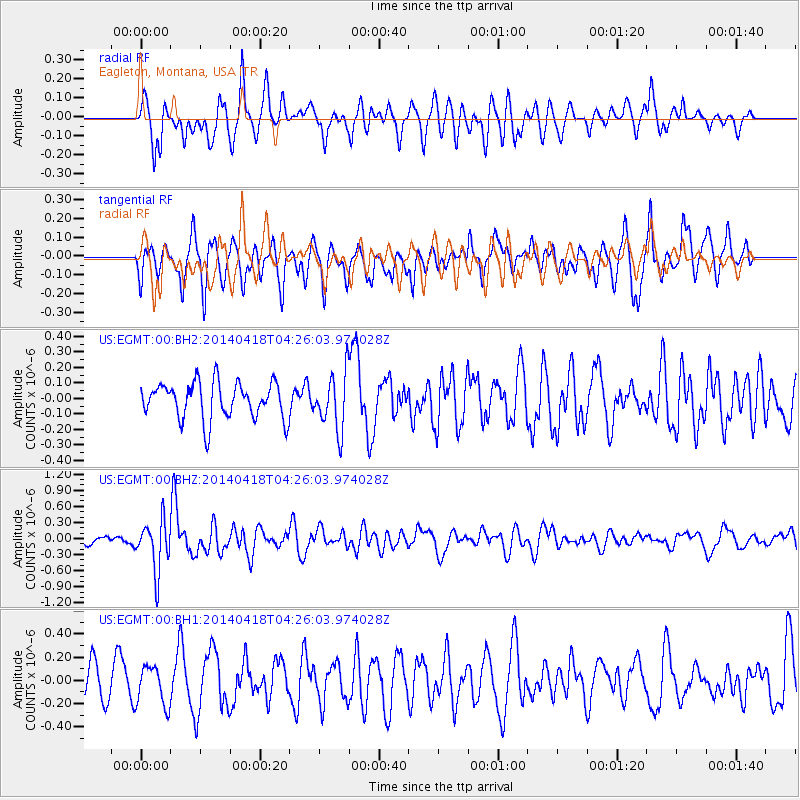
EGMT Eagleton, Montana, USA - Earthquake Result Viewer
*The percent match for this event was below the threshold and hence no stack was calculated.
| Earthquake location: |
Santa Cruz Islands Region |
| Earthquake latitude/longitude: |
-11.2/164.8 |
| Earthquake time(UTC): |
2014/04/18 (108) 04:13:12 GMT |
| Earthquake Depth: |
10 km |
| Earthquake Magnitude: |
6.0 MB |
| Earthquake Catalog/Contributor: |
NEIC PDE/NEIC COMCAT |
|
| Network: |
US United States National Seismic Network |
| Station: |
EGMT Eagleton, Montana, USA |
| Lat/Lon: |
48.02 N/109.75 W |
| Elevation: |
1055 m |
|
| Distance: |
95.2 deg |
| Az: |
42.214 deg |
| Baz: |
259.185 deg |
| Ray Param: |
$rayparam |
*The percent match for this event was below the threshold and hence was not used in the summary stack. |
|
| Radial Match: |
60.873966 % |
| Radial Bump: |
400 |
| Transverse Match: |
52.837334 % |
| Transverse Bump: |
400 |
| SOD ConfigId: |
626651 |
| Insert Time: |
2014-05-02 04:48:10.199 +0000 |
| GWidth: |
2.5 |
| Max Bumps: |
400 |
| Tol: |
0.001 |
|
Signal To Noise
| Channel | StoN | STA | LTA |
| US:EGMT:00:BHZ:20140418T04:26:03.974028Z | 5.0016336 | 4.7007674E-7 | 9.398464E-8 |
| US:EGMT:00:BH1:20140418T04:26:03.974028Z | 0.7621876 | 1.6671068E-7 | 2.1872658E-7 |
| US:EGMT:00:BH2:20140418T04:26:03.974028Z | 1.5355095 | 1.8116042E-7 | 1.17980655E-7 |
| Arrivals |
| Ps | |
| PpPs | |
| PsPs/PpSs | |


