You are here: Home > Network List > US - United States National Seismic Network Stations List
> Station MSO Missoula, Montana, USA > Earthquake Result Viewer
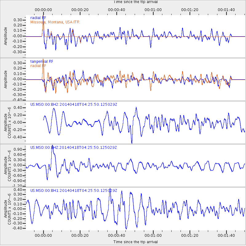
MSO Missoula, Montana, USA - Earthquake Result Viewer
*The percent match for this event was below the threshold and hence no stack was calculated.
| Earthquake location: |
Santa Cruz Islands Region |
| Earthquake latitude/longitude: |
-11.2/164.8 |
| Earthquake time(UTC): |
2014/04/18 (108) 04:13:12 GMT |
| Earthquake Depth: |
10 km |
| Earthquake Magnitude: |
6.0 MB |
| Earthquake Catalog/Contributor: |
NEIC PDE/NEIC COMCAT |
|
| Network: |
US United States National Seismic Network |
| Station: |
MSO Missoula, Montana, USA |
| Lat/Lon: |
46.83 N/113.94 W |
| Elevation: |
1264 m |
|
| Distance: |
92.1 deg |
| Az: |
42.774 deg |
| Baz: |
256.075 deg |
| Ray Param: |
$rayparam |
*The percent match for this event was below the threshold and hence was not used in the summary stack. |
|
| Radial Match: |
61.064262 % |
| Radial Bump: |
400 |
| Transverse Match: |
68.17254 % |
| Transverse Bump: |
400 |
| SOD ConfigId: |
626651 |
| Insert Time: |
2014-05-02 04:48:39.617 +0000 |
| GWidth: |
2.5 |
| Max Bumps: |
400 |
| Tol: |
0.001 |
|
Signal To Noise
| Channel | StoN | STA | LTA |
| US:MSO:00:BHZ:20140418T04:25:50.125029Z | 3.3729124 | 4.0057654E-7 | 1.187628E-7 |
| US:MSO:00:BH1:20140418T04:25:50.125029Z | 0.5652144 | 8.219048E-8 | 1.454147E-7 |
| US:MSO:00:BH2:20140418T04:25:50.125029Z | 1.028459 | 1.6394345E-7 | 1.5940691E-7 |
| Arrivals |
| Ps | |
| PpPs | |
| PsPs/PpSs | |


