You are here: Home > Network List > UW - Pacific Northwest Regional Seismic Network Stations List
> Station MRBL Marblemount, WA, USA > Earthquake Result Viewer
MRBL Marblemount, WA, USA - Earthquake Result Viewer
*The percent match for this event was below the threshold and hence no stack was calculated.
| Earthquake location: |
Santa Cruz Islands Region |
| Earthquake latitude/longitude: |
-11.2/164.8 |
| Earthquake time(UTC): |
2014/04/18 (108) 04:13:12 GMT |
| Earthquake Depth: |
10 km |
| Earthquake Magnitude: |
6.0 MB |
| Earthquake Catalog/Contributor: |
NEIC PDE/NEIC COMCAT |
|
| Network: |
UW Pacific Northwest Regional Seismic Network |
| Station: |
MRBL Marblemount, WA, USA |
| Lat/Lon: |
48.52 N/121.48 W |
| Elevation: |
75 m |
|
| Distance: |
87.7 deg |
| Az: |
39.693 deg |
| Baz: |
250.507 deg |
| Ray Param: |
$rayparam |
*The percent match for this event was below the threshold and hence was not used in the summary stack. |
|
| Radial Match: |
70.182236 % |
| Radial Bump: |
400 |
| Transverse Match: |
48.341038 % |
| Transverse Bump: |
400 |
| SOD ConfigId: |
626651 |
| Insert Time: |
2014-05-02 04:51:47.943 +0000 |
| GWidth: |
2.5 |
| Max Bumps: |
400 |
| Tol: |
0.001 |
|
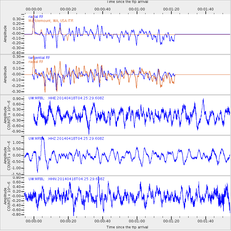
Signal To Noise
| Channel | StoN | STA | LTA |
| UW:MRBL: :HHZ:20140418T04:25:29.608Z | 2.7895038 | 5.828789E-7 | 2.0895432E-7 |
| UW:MRBL: :HHN:20140418T04:25:29.608Z | 1.1529131 | 2.1342848E-7 | 1.8512104E-7 |
| UW:MRBL: :HHE:20140418T04:25:29.608Z | 1.5256649 | 4.3009894E-7 | 2.8190917E-7 |
| Arrivals |
| Ps | |
| PpPs | |
| PsPs/PpSs | |


