You are here: Home > Network List > UW - Pacific Northwest Regional Seismic Network Stations List
> Station UMAT Pilot Rock, OR, USA > Earthquake Result Viewer
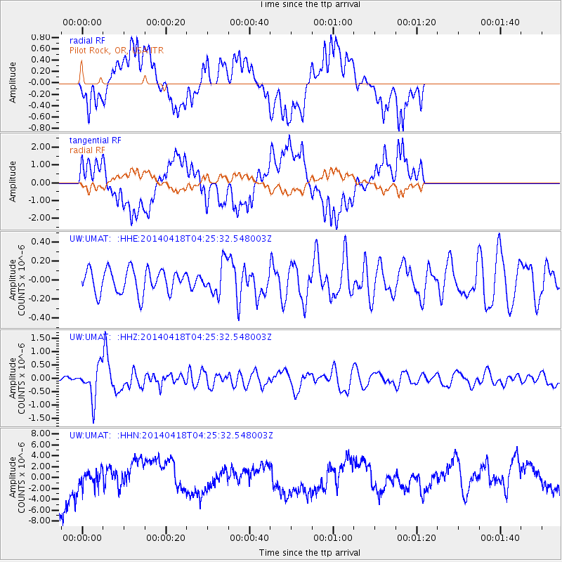
UMAT Pilot Rock, OR, USA - Earthquake Result Viewer
*The percent match for this event was below the threshold and hence no stack was calculated.
| Earthquake location: |
Santa Cruz Islands Region |
| Earthquake latitude/longitude: |
-11.2/164.8 |
| Earthquake time(UTC): |
2014/04/18 (108) 04:13:12 GMT |
| Earthquake Depth: |
10 km |
| Earthquake Magnitude: |
6.0 MB |
| Earthquake Catalog/Contributor: |
NEIC PDE/NEIC COMCAT |
|
| Network: |
UW Pacific Northwest Regional Seismic Network |
| Station: |
UMAT Pilot Rock, OR, USA |
| Lat/Lon: |
45.29 N/118.96 W |
| Elevation: |
1318 m |
|
| Distance: |
88.4 deg |
| Az: |
43.307 deg |
| Baz: |
252.469 deg |
| Ray Param: |
$rayparam |
*The percent match for this event was below the threshold and hence was not used in the summary stack. |
|
| Radial Match: |
38.76664 % |
| Radial Bump: |
400 |
| Transverse Match: |
38.865807 % |
| Transverse Bump: |
400 |
| SOD ConfigId: |
626651 |
| Insert Time: |
2014-05-02 04:52:21.510 +0000 |
| GWidth: |
2.5 |
| Max Bumps: |
400 |
| Tol: |
0.001 |
|
Signal To Noise
| Channel | StoN | STA | LTA |
| UW:UMAT: :HHZ:20140418T04:25:32.548003Z | 3.8702753 | 6.2528164E-7 | 1.6156E-7 |
| UW:UMAT: :HHN:20140418T04:25:32.548003Z | 0.45677382 | 1.5987716E-6 | 3.5001385E-6 |
| UW:UMAT: :HHE:20140418T04:25:32.548003Z | 1.3402967 | 1.6805285E-7 | 1.253848E-7 |
| Arrivals |
| Ps | |
| PpPs | |
| PsPs/PpSs | |


