GAMB Gambell Broadband - Earthquake Result Viewer
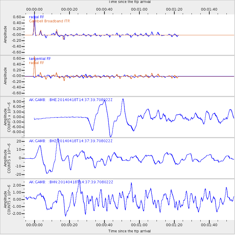
Earthquake location: Guerrero, Mexico
Earthquake latitude/longitude: 17.6/-100.8
Earthquake time(UTC): 2014/04/18 (108) 14:27:26 GMT
Earthquake Depth: 24 km
Earthquake Magnitude: 7.2 MWW, 7.0 MWB, 7.3 MWC, 7.5 MI
Earthquake Catalog/Contributor: NEIC PDE/NEIC COMCAT
Network: AK Alaska Regional Network
Station: GAMB Gambell Broadband
Lat/Lon: 63.78 N/171.70 W
Elevation: 10 m
Distance: 66.0 deg
Az: 332.637 deg
Baz: 99.245 deg
Ray Param: 0.057896234
Estimated Moho Depth: 33.25 km
Estimated Crust Vp/Vs: 1.66
Assumed Crust Vp: 6.24 km/s
Estimated Crust Vs: 3.748 km/s
Estimated Crust Poisson's Ratio: 0.22
Radial Match: 97.49192 %
Radial Bump: 187
Transverse Match: 73.34461 %
Transverse Bump: 400
SOD ConfigId: 626651
Insert Time: 2014-05-02 14:38:41.338 +0000
GWidth: 2.5
Max Bumps: 400
Tol: 0.001

Signal To Noise

ChannelStoNSTALTA
AK:GAMB: :BHZ:20140418T14:37:39.708022Z83.731368.485363E-61.0134032E-7
AK:GAMB: :BHN:20140418T14:37:39.708022Z1.67941747.370262E-74.3885828E-7
AK:GAMB: :BHE:20140418T14:37:39.708022Z10.0114064.010568E-64.0059987E-7
Arrivals
Ps3.7 SECOND
PpPs14 SECOND
PsPs/PpSs17 SECOND