435B Jarrell, TX, USA - Earthquake Result Viewer
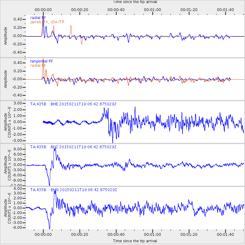
Earthquake location: Jujuy Province, Argentina
Earthquake latitude/longitude: -23.1/-66.7
Earthquake time(UTC): 2015/02/11 (042) 18:57:22 GMT
Earthquake Depth: 223 km
Earthquake Magnitude: 6.7 MWW, 6.7 MWC, 6.7 MWB, 6.9 MI
Earthquake Catalog/Contributor: NEIC PDE/NEIC COMCAT
Network: TA USArray Transportable Network (new EarthScope stations)
Station: 435B Jarrell, TX, USA
Lat/Lon: 30.78 N/97.58 W
Elevation: 248 m
Distance: 61.2 deg
Az: 329.728 deg
Baz: 147.364 deg
Ray Param: 0.060302846
Estimated Moho Depth: 15.5 km
Estimated Crust Vp/Vs: 1.71
Assumed Crust Vp: 6.347 km/s
Estimated Crust Vs: 3.717 km/s
Estimated Crust Poisson's Ratio: 0.24
Radial Match: 94.815025 %
Radial Bump: 400
Transverse Match: 78.34121 %
Transverse Bump: 400
SOD ConfigId: 7019011
Insert Time: 2019-04-16 18:15:41.294 +0000
GWidth: 2.5
Max Bumps: 400
Tol: 0.001

Signal To Noise

ChannelStoNSTALTA
TA:435B: :BHZ:20150211T19:06:42.875029Z33.8164.673295E-61.3819773E-7
TA:435B: :BHN:20150211T19:06:42.875029Z9.1344551.7004545E-61.861583E-7
TA:435B: :BHE:20150211T19:06:42.875029Z5.10369549.621497E-71.8852019E-7
Arrivals
Ps1.8 SECOND
PpPs6.3 SECOND
PsPs/PpSs8.1 SECOND