
C06D Leavenworth, WQ, USA - Earthquake Result Viewer
| ||||||||||||||||||
| ||||||||||||||||||
| ||||||||||||||||||
|
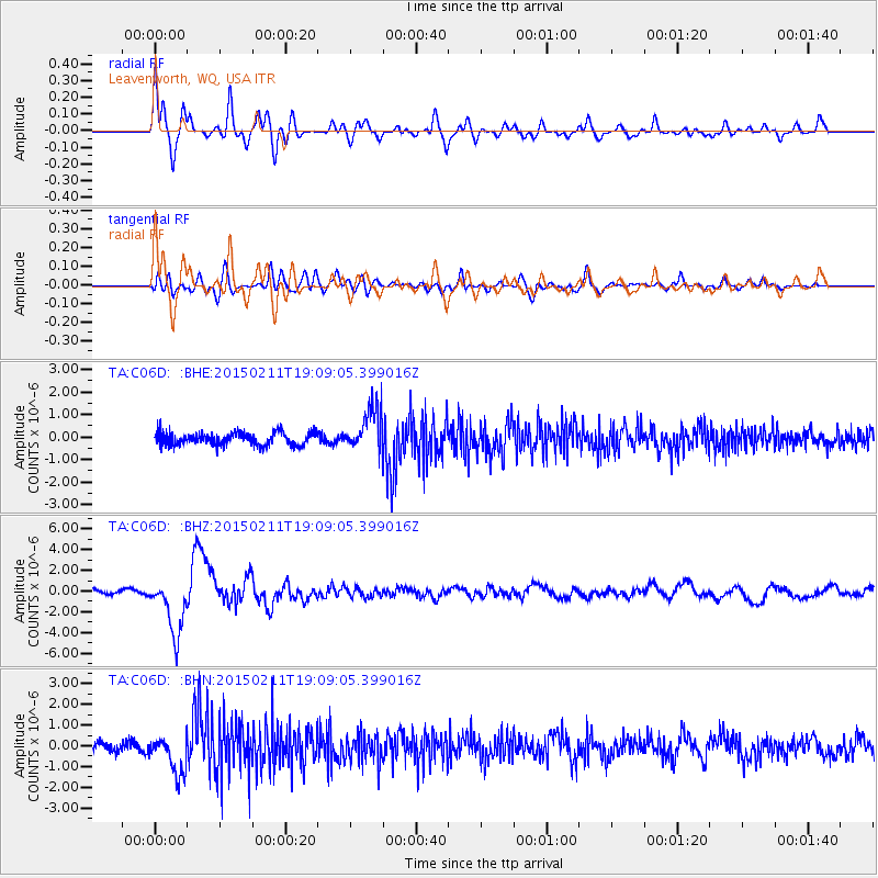
Signal To Noise
| Channel | StoN | STA | LTA |
| TA:C06D: :BHZ:20150211T19:09:05.399016Z | 11.522449 | 2.7541405E-6 | 2.390239E-7 |
| TA:C06D: :BHN:20150211T19:09:05.399016Z | 3.480532 | 9.2374376E-7 | 2.6540303E-7 |
| TA:C06D: :BHE:20150211T19:09:05.399016Z | 3.5100613 | 9.830633E-7 | 2.8007014E-7 |
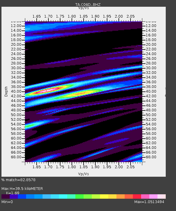
| Arrivals | |
| Ps | 4.2 SECOND |
| PpPs | 16 SECOND |
| PsPs/PpSs | 20 SECOND |

