G03D McMinnville, OR, USA - Earthquake Result Viewer
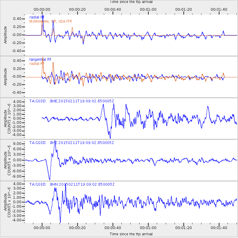
Earthquake location: Jujuy Province, Argentina
Earthquake latitude/longitude: -23.1/-66.7
Earthquake time(UTC): 2015/02/11 (042) 18:57:22 GMT
Earthquake Depth: 223 km
Earthquake Magnitude: 6.7 MWW, 6.7 MWC, 6.7 MWB, 6.9 MI
Earthquake Catalog/Contributor: NEIC PDE/NEIC COMCAT
Network: TA USArray Transportable Network (new EarthScope stations)
Station: G03D McMinnville, OR, USA
Lat/Lon: 45.21 N/123.26 W
Elevation: 222 m
Distance: 85.3 deg
Az: 323.703 deg
Baz: 129.551 deg
Ray Param: 0.04435193
Estimated Moho Depth: 37.75 km
Estimated Crust Vp/Vs: 2.05
Assumed Crust Vp: 6.566 km/s
Estimated Crust Vs: 3.207 km/s
Estimated Crust Poisson's Ratio: 0.34
Radial Match: 90.652916 %
Radial Bump: 400
Transverse Match: 85.56947 %
Transverse Bump: 400
SOD ConfigId: 7019011
Insert Time: 2019-04-16 18:16:11.251 +0000
GWidth: 2.5
Max Bumps: 400
Tol: 0.001

Signal To Noise

ChannelStoNSTALTA
TA:G03D: :BHZ:20150211T19:09:02.850005Z14.9909364.5597935E-63.0417004E-7
TA:G03D: :BHN:20150211T19:09:02.850005Z4.4074431.0455663E-62.372274E-7
TA:G03D: :BHE:20150211T19:09:02.850005Z5.2406351.2835787E-62.4492812E-7
Arrivals
Ps6.2 SECOND
PpPs17 SECOND
PsPs/PpSs23 SECOND