You are here: Home > Network List > TA - USArray Transportable Network (new EarthScope stations) Stations List
> Station H17A Grant Village (NPS), Yellowstone Nt. Park, WY, USA > Earthquake Result Viewer
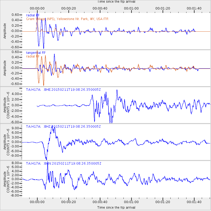
H17A Grant Village (NPS), Yellowstone Nt. Park, WY, USA - Earthquake Result Viewer
*The percent match for this event was below the threshold and hence no stack was calculated.
| Earthquake location: |
Jujuy Province, Argentina |
| Earthquake latitude/longitude: |
-23.1/-66.7 |
| Earthquake time(UTC): |
2015/02/11 (042) 18:57:22 GMT |
| Earthquake Depth: |
223 km |
| Earthquake Magnitude: |
6.7 MWW, 6.7 MWC, 6.7 MWB, 6.9 MI |
| Earthquake Catalog/Contributor: |
NEIC PDE/NEIC COMCAT |
|
| Network: |
TA USArray Transportable Network (new EarthScope stations) |
| Station: |
H17A Grant Village (NPS), Yellowstone Nt. Park, WY, USA |
| Lat/Lon: |
44.40 N/110.58 W |
| Elevation: |
2400 m |
|
| Distance: |
78.2 deg |
| Az: |
329.497 deg |
| Baz: |
139.313 deg |
| Ray Param: |
$rayparam |
*The percent match for this event was below the threshold and hence was not used in the summary stack. |
|
| Radial Match: |
76.46277 % |
| Radial Bump: |
400 |
| Transverse Match: |
88.84381 % |
| Transverse Bump: |
400 |
| SOD ConfigId: |
7019011 |
| Insert Time: |
2019-04-16 18:16:20.801 +0000 |
| GWidth: |
2.5 |
| Max Bumps: |
400 |
| Tol: |
0.001 |
|
Signal To Noise
| Channel | StoN | STA | LTA |
| TA:H17A: :BHZ:20150211T19:08:26.350005Z | 12.375847 | 2.1326696E-6 | 1.7232516E-7 |
| TA:H17A: :BHN:20150211T19:08:26.350005Z | 5.196594 | 1.0469598E-6 | 2.0147037E-7 |
| TA:H17A: :BHE:20150211T19:08:26.350005Z | 6.193453 | 9.2090994E-7 | 1.4869087E-7 |
| Arrivals |
| Ps | |
| PpPs | |
| PsPs/PpSs | |


