You are here: Home > Network List > TA - USArray Transportable Network (new EarthScope stations) Stations List
> Station H63A New Sharon, ME, USA > Earthquake Result Viewer
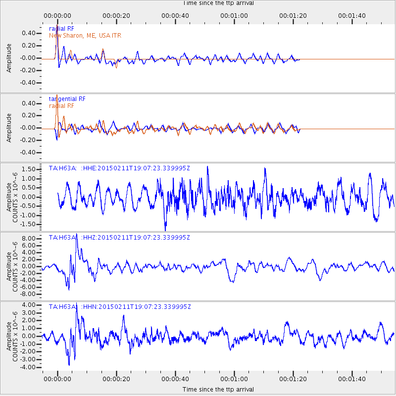
H63A New Sharon, ME, USA - Earthquake Result Viewer
*The percent match for this event was below the threshold and hence no stack was calculated.
| Earthquake location: |
Jujuy Province, Argentina |
| Earthquake latitude/longitude: |
-23.1/-66.7 |
| Earthquake time(UTC): |
2015/02/11 (042) 18:57:22 GMT |
| Earthquake Depth: |
223 km |
| Earthquake Magnitude: |
6.7 MWW, 6.7 MWC, 6.7 MWB, 6.9 MI |
| Earthquake Catalog/Contributor: |
NEIC PDE/NEIC COMCAT |
|
| Network: |
TA USArray Transportable Network (new EarthScope stations) |
| Station: |
H63A New Sharon, ME, USA |
| Lat/Lon: |
44.66 N/70.04 W |
| Elevation: |
109 m |
|
| Distance: |
67.5 deg |
| Az: |
357.417 deg |
| Baz: |
176.667 deg |
| Ray Param: |
$rayparam |
*The percent match for this event was below the threshold and hence was not used in the summary stack. |
|
| Radial Match: |
70.74423 % |
| Radial Bump: |
400 |
| Transverse Match: |
55.32902 % |
| Transverse Bump: |
400 |
| SOD ConfigId: |
7019011 |
| Insert Time: |
2019-04-16 18:16:28.696 +0000 |
| GWidth: |
2.5 |
| Max Bumps: |
400 |
| Tol: |
0.001 |
|
Signal To Noise
| Channel | StoN | STA | LTA |
| TA:H63A: :HHZ:20150211T19:07:23.339995Z | 5.2485147 | 2.7148385E-6 | 5.1725846E-7 |
| TA:H63A: :HHN:20150211T19:07:23.339995Z | 2.5721326 | 1.3888929E-6 | 5.399772E-7 |
| TA:H63A: :HHE:20150211T19:07:23.339995Z | 1.1560379 | 5.115673E-7 | 4.4251777E-7 |
| Arrivals |
| Ps | |
| PpPs | |
| PsPs/PpSs | |


