I05D Terrebonne, OR, USA - Earthquake Result Viewer
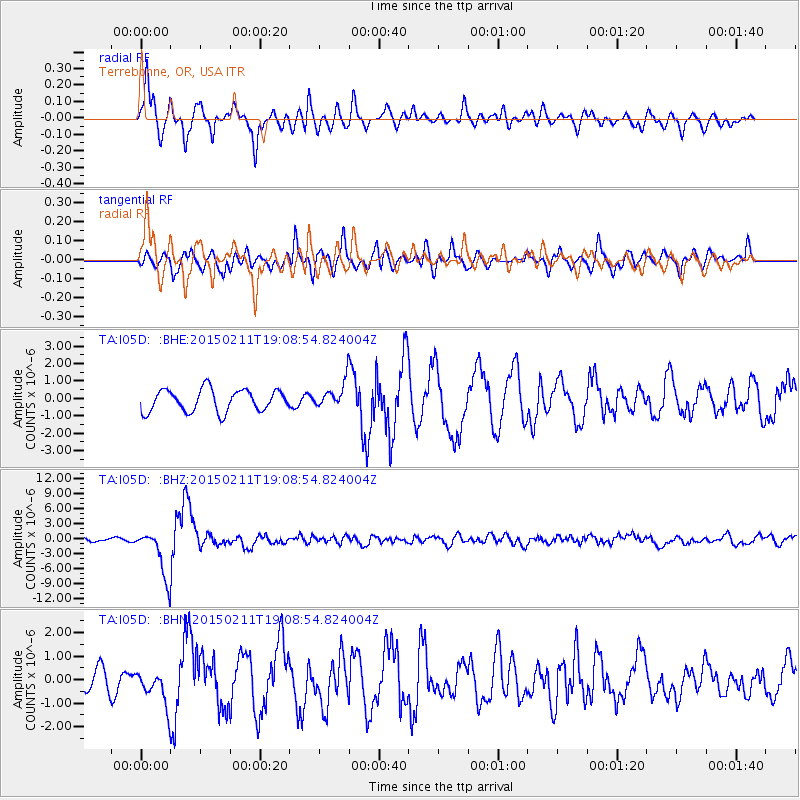
Earthquake location: Jujuy Province, Argentina
Earthquake latitude/longitude: -23.1/-66.7
Earthquake time(UTC): 2015/02/11 (042) 18:57:22 GMT
Earthquake Depth: 223 km
Earthquake Magnitude: 6.7 MWW, 6.7 MWC, 6.7 MWB, 6.9 MI
Earthquake Catalog/Contributor: NEIC PDE/NEIC COMCAT
Network: TA USArray Transportable Network (new EarthScope stations)
Station: I05D Terrebonne, OR, USA
Lat/Lon: 44.34 N/121.34 W
Elevation: 1546 m
Distance: 83.7 deg
Az: 323.924 deg
Baz: 130.924 deg
Ray Param: 0.045490827
Estimated Moho Depth: 33.25 km
Estimated Crust Vp/Vs: 1.92
Assumed Crust Vp: 6.597 km/s
Estimated Crust Vs: 3.436 km/s
Estimated Crust Poisson's Ratio: 0.31
Radial Match: 88.173096 %
Radial Bump: 400
Transverse Match: 75.48163 %
Transverse Bump: 400
SOD ConfigId: 7019011
Insert Time: 2019-04-16 18:16:33.778 +0000
GWidth: 2.5
Max Bumps: 400
Tol: 0.001

Signal To Noise

ChannelStoNSTALTA
TA:I05D: :BHZ:20150211T19:08:54.824004Z15.3468524.8141546E-63.1369004E-7
TA:I05D: :BHN:20150211T19:08:54.824004Z1.97128747.406066E-73.7569694E-7
TA:I05D: :BHE:20150211T19:08:54.824004Z0.976802476.1636524E-76.3100293E-7
Arrivals
Ps4.7 SECOND
PpPs14 SECOND
PsPs/PpSs19 SECOND