J61A Chester, VT, USA - Earthquake Result Viewer
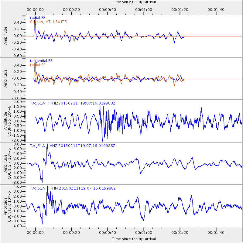
Earthquake location: Jujuy Province, Argentina
Earthquake latitude/longitude: -23.1/-66.7
Earthquake time(UTC): 2015/02/11 (042) 18:57:22 GMT
Earthquake Depth: 223 km
Earthquake Magnitude: 6.7 MWW, 6.7 MWC, 6.7 MWB, 6.9 MI
Earthquake Catalog/Contributor: NEIC PDE/NEIC COMCAT
Network: TA USArray Transportable Network (new EarthScope stations)
Station: J61A Chester, VT, USA
Lat/Lon: 43.35 N/72.55 W
Elevation: 253 m
Distance: 66.3 deg
Az: 355.334 deg
Baz: 174.107 deg
Ray Param: 0.057010673
Estimated Moho Depth: 64.0 km
Estimated Crust Vp/Vs: 1.62
Assumed Crust Vp: 6.419 km/s
Estimated Crust Vs: 3.962 km/s
Estimated Crust Poisson's Ratio: 0.19
Radial Match: 82.38627 %
Radial Bump: 400
Transverse Match: 62.682625 %
Transverse Bump: 400
SOD ConfigId: 7019011
Insert Time: 2019-04-16 18:16:46.790 +0000
GWidth: 2.5
Max Bumps: 400
Tol: 0.001

Signal To Noise

ChannelStoNSTALTA
TA:J61A: :HHZ:20150211T19:07:16.019988Z5.8902143.310895E-65.62101E-7
TA:J61A: :HHN:20150211T19:07:16.019988Z2.45930891.3063318E-65.3117844E-7
TA:J61A: :HHE:20150211T19:07:16.019988Z1.25826755.997732E-74.766659E-7
Arrivals
Ps6.5 SECOND
PpPs25 SECOND
PsPs/PpSs31 SECOND