You are here: Home > Network List > CU - Caribbean Network (USGS) Stations List
> Station BBGH Gun Hill, Barbados > Earthquake Result Viewer
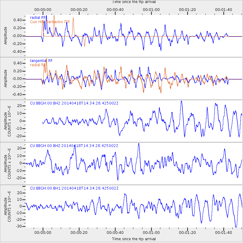
BBGH Gun Hill, Barbados - Earthquake Result Viewer
*The percent match for this event was below the threshold and hence no stack was calculated.
| Earthquake location: |
Guerrero, Mexico |
| Earthquake latitude/longitude: |
17.6/-100.8 |
| Earthquake time(UTC): |
2014/04/18 (108) 14:27:26 GMT |
| Earthquake Depth: |
24 km |
| Earthquake Magnitude: |
7.2 MWW, 7.0 MWB, 7.3 MWC, 7.5 MI |
| Earthquake Catalog/Contributor: |
NEIC PDE/NEIC COMCAT |
|
| Network: |
CU Caribbean Network (USGS) |
| Station: |
BBGH Gun Hill, Barbados |
| Lat/Lon: |
13.14 N/59.56 W |
| Elevation: |
180 m |
|
| Distance: |
40.0 deg |
| Az: |
90.352 deg |
| Baz: |
281.669 deg |
| Ray Param: |
$rayparam |
*The percent match for this event was below the threshold and hence was not used in the summary stack. |
|
| Radial Match: |
79.204445 % |
| Radial Bump: |
366 |
| Transverse Match: |
76.31306 % |
| Transverse Bump: |
400 |
| SOD ConfigId: |
626651 |
| Insert Time: |
2014-05-02 14:48:31.790 +0000 |
| GWidth: |
2.5 |
| Max Bumps: |
400 |
| Tol: |
0.001 |
|
Signal To Noise
| Channel | StoN | STA | LTA |
| CU:BBGH:00:BHZ:20140418T14:34:28.425002Z | 3.405749 | 9.009188E-6 | 2.645288E-6 |
| CU:BBGH:00:BH1:20140418T14:34:28.425002Z | 0.51121193 | 1.6493892E-6 | 3.2264293E-6 |
| CU:BBGH:00:BH2:20140418T14:34:28.425002Z | 2.1362774 | 5.2731516E-6 | 2.4683834E-6 |
| Arrivals |
| Ps | |
| PpPs | |
| PsPs/PpSs | |


