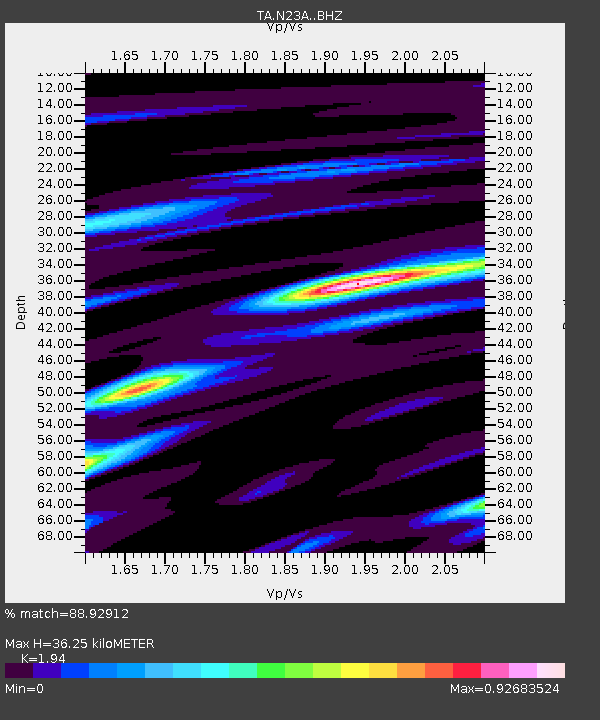
N23A Red Feather Lakes, CO, USA - Earthquake Result Viewer
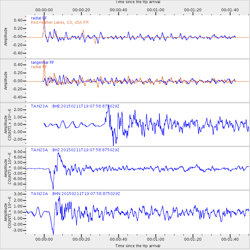
Earthquake location: Jujuy Province, Argentina
Earthquake latitude/longitude: -23.1/-66.7
Earthquake time(UTC): 2015/02/11 (042) 18:57:22 GMT
Earthquake Depth: 223 km
Earthquake Magnitude: 6.7 MWW, 6.7 MWC, 6.7 MWB, 6.9 MI
Earthquake Catalog/Contributor: NEIC PDE/NEIC COMCAT
Network: TA USArray Transportable Network (new EarthScope stations)
Station: N23A Red Feather Lakes, CO, USA
Lat/Lon: 40.89 N/105.94 W
Elevation: 2458 m
Distance: 73.4 deg
Az: 329.961 deg
Baz: 142.556 deg
Ray Param: 0.052431062
Estimated Moho Depth: 36.25 km
Estimated Crust Vp/Vs: 1.94
Assumed Crust Vp: 6.306 km/s
Estimated Crust Vs: 3.251 km/s
Estimated Crust Poisson's Ratio: 0.32
Radial Match: 88.92912 %
Radial Bump: 400
Transverse Match: 75.655914 %
Transverse Bump: 400
SOD ConfigId: 7019011
Insert Time: 2019-04-16 18:17:27.249 +0000
GWidth: 2.5
Max Bumps: 400
Tol: 0.001

Signal To Noise

ChannelStoNSTALTA
TA:N23A: :BHZ:20150211T19:07:58.875029Z22.0538463.9129063E-61.7742511E-7
TA:N23A: :BHN:20150211T19:07:58.875029Z4.85263731.2054371E-62.4840867E-7
TA:N23A: :BHE:20150211T19:07:58.875029Z4.2829811.0359076E-62.4186605E-7
Arrivals
Ps5.6 SECOND
PpPs16 SECOND
PsPs/PpSs22 SECOND