You are here: Home > Network List > G - GEOSCOPE Stations List
> Station TAOE Taiohae, Marquises islands > Earthquake Result Viewer
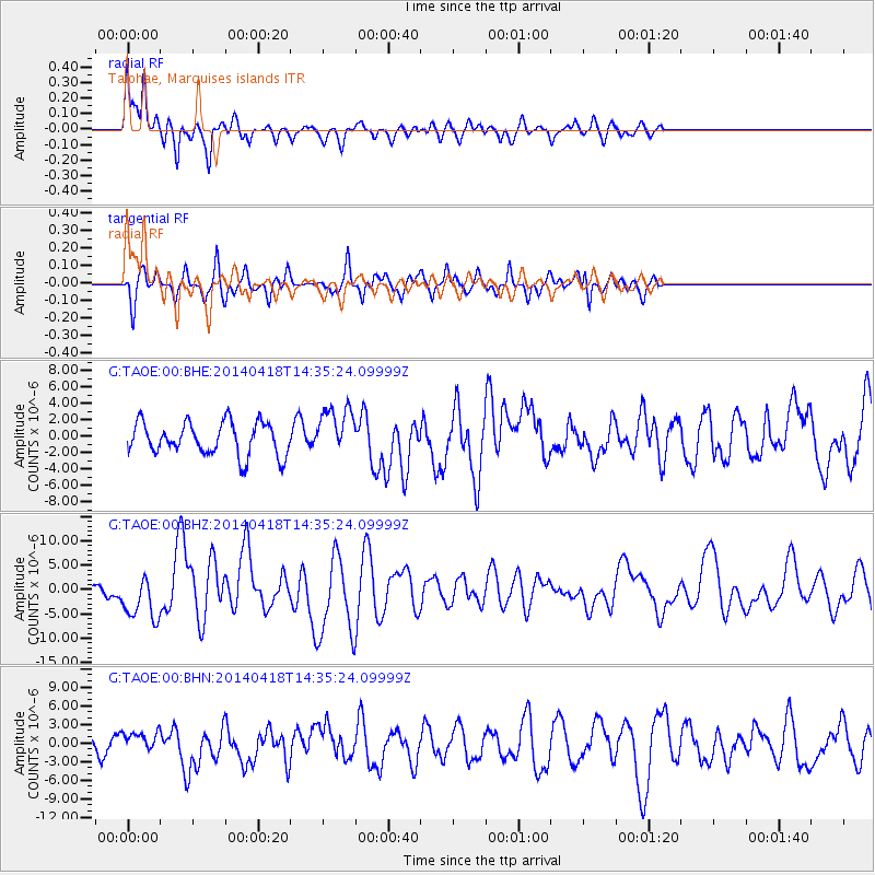
TAOE Taiohae, Marquises islands - Earthquake Result Viewer
*The percent match for this event was below the threshold and hence no stack was calculated.
| Earthquake location: |
Guerrero, Mexico |
| Earthquake latitude/longitude: |
17.6/-100.8 |
| Earthquake time(UTC): |
2014/04/18 (108) 14:27:26 GMT |
| Earthquake Depth: |
24 km |
| Earthquake Magnitude: |
7.2 MWW, 7.0 MWB, 7.3 MWC, 7.5 MI |
| Earthquake Catalog/Contributor: |
NEIC PDE/NEIC COMCAT |
|
| Network: |
G GEOSCOPE |
| Station: |
TAOE Taiohae, Marquises islands |
| Lat/Lon: |
8.85 S/140.15 W |
| Elevation: |
800 m |
|
| Distance: |
46.9 deg |
| Az: |
239.09 deg |
| Baz: |
55.922 deg |
| Ray Param: |
$rayparam |
*The percent match for this event was below the threshold and hence was not used in the summary stack. |
|
| Radial Match: |
74.78066 % |
| Radial Bump: |
400 |
| Transverse Match: |
57.487774 % |
| Transverse Bump: |
324 |
| SOD ConfigId: |
626651 |
| Insert Time: |
2014-05-02 14:50:11.210 +0000 |
| GWidth: |
2.5 |
| Max Bumps: |
400 |
| Tol: |
0.001 |
|
Signal To Noise
| Channel | StoN | STA | LTA |
| G:TAOE:00:BHZ:20140418T14:35:24.09999Z | 2.9578428 | 4.6875753E-6 | 1.5847952E-6 |
| G:TAOE:00:BHN:20140418T14:35:24.09999Z | 0.9383315 | 1.5612522E-6 | 1.6638601E-6 |
| G:TAOE:00:BHE:20140418T14:35:24.09999Z | 1.4883958 | 2.9611188E-6 | 1.98947E-6 |
| Arrivals |
| Ps | |
| PpPs | |
| PsPs/PpSs | |


