O48A Farmland, IN, USA - Earthquake Result Viewer
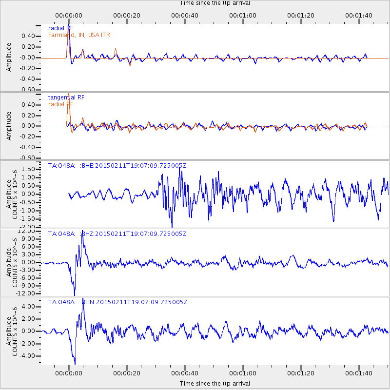
Earthquake location: Jujuy Province, Argentina
Earthquake latitude/longitude: -23.1/-66.7
Earthquake time(UTC): 2015/02/11 (042) 18:57:22 GMT
Earthquake Depth: 223 km
Earthquake Magnitude: 6.7 MWW, 6.7 MWC, 6.7 MWB, 6.9 MI
Earthquake Catalog/Contributor: NEIC PDE/NEIC COMCAT
Network: TA USArray Transportable Network (new EarthScope stations)
Station: O48A Farmland, IN, USA
Lat/Lon: 40.26 N/85.16 W
Elevation: 300 m
Distance: 65.3 deg
Az: 344.533 deg
Baz: 161.285 deg
Ray Param: 0.057659794
Estimated Moho Depth: 39.75 km
Estimated Crust Vp/Vs: 1.78
Assumed Crust Vp: 6.498 km/s
Estimated Crust Vs: 3.655 km/s
Estimated Crust Poisson's Ratio: 0.27
Radial Match: 90.80118 %
Radial Bump: 400
Transverse Match: 78.425064 %
Transverse Bump: 400
SOD ConfigId: 7019011
Insert Time: 2019-04-16 18:17:37.354 +0000
GWidth: 2.5
Max Bumps: 400
Tol: 0.001

Signal To Noise

ChannelStoNSTALTA
TA:O48A: :BHZ:20150211T19:07:09.725005Z19.7795285.9936847E-63.0302465E-7
TA:O48A: :BHN:20150211T19:07:09.725005Z11.5765312.6580847E-62.2960977E-7
TA:O48A: :BHE:20150211T19:07:09.725005Z3.5997266.758319E-71.8774539E-7
Arrivals
Ps5.0 SECOND
PpPs16 SECOND
PsPs/PpSs21 SECOND