O60A Telford, PA, USA - Earthquake Result Viewer
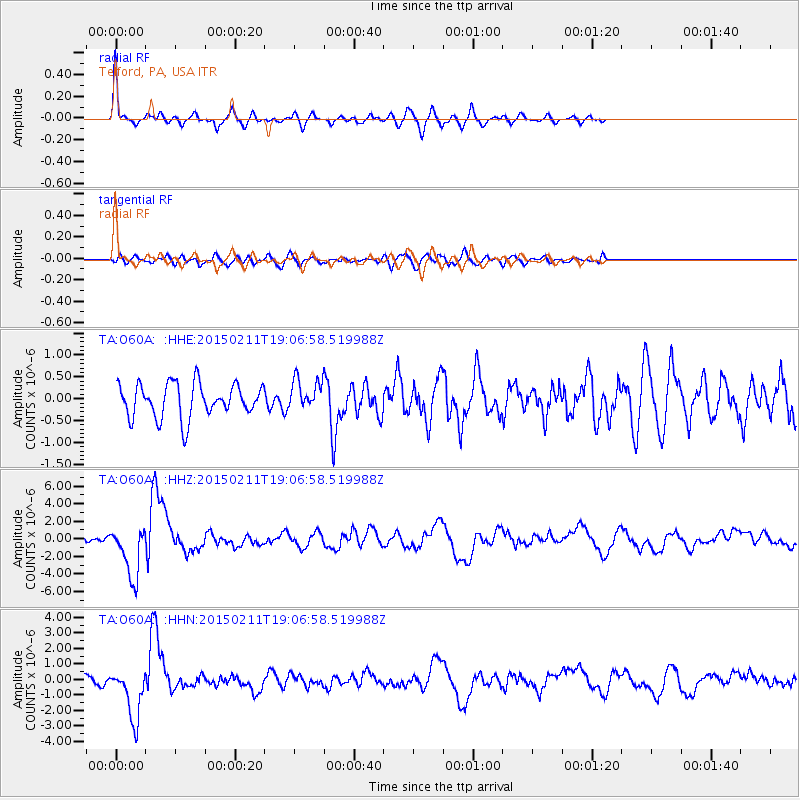
Earthquake location: Jujuy Province, Argentina
Earthquake latitude/longitude: -23.1/-66.7
Earthquake time(UTC): 2015/02/11 (042) 18:57:22 GMT
Earthquake Depth: 223 km
Earthquake Magnitude: 6.7 MWW, 6.7 MWC, 6.7 MWB, 6.9 MI
Earthquake Catalog/Contributor: NEIC PDE/NEIC COMCAT
Network: TA USArray Transportable Network (new EarthScope stations)
Station: O60A Telford, PA, USA
Lat/Lon: 40.32 N/75.40 W
Elevation: 70 m
Distance: 63.6 deg
Az: 352.57 deg
Baz: 171.042 deg
Ray Param: 0.05877338
Estimated Moho Depth: 41.5 km
Estimated Crust Vp/Vs: 2.10
Assumed Crust Vp: 6.283 km/s
Estimated Crust Vs: 2.996 km/s
Estimated Crust Poisson's Ratio: 0.35
Radial Match: 82.3518 %
Radial Bump: 399
Transverse Match: 46.600704 %
Transverse Bump: 400
SOD ConfigId: 7019011
Insert Time: 2019-04-16 18:17:43.966 +0000
GWidth: 2.5
Max Bumps: 400
Tol: 0.001

Signal To Noise

ChannelStoNSTALTA
TA:O60A: :HHZ:20150211T19:06:58.519988Z6.3429252.9655673E-64.675394E-7
TA:O60A: :HHN:20150211T19:06:58.519988Z5.3657091.688648E-63.1471106E-7
TA:O60A: :HHE:20150211T19:06:58.519988Z1.01390483.8671683E-73.8141334E-7
Arrivals
Ps7.5 SECOND
PpPs20 SECOND
PsPs/PpSs27 SECOND