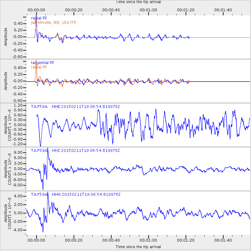
P59A Jarrettsville, MD, USA - Earthquake Result Viewer
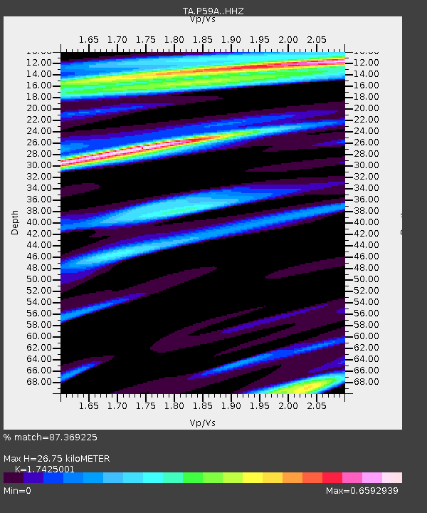
Earthquake location: Jujuy Province, Argentina
Earthquake latitude/longitude: -23.1/-66.7
Earthquake time(UTC): 2015/02/11 (042) 18:57:22 GMT
Earthquake Depth: 223 km
Earthquake Magnitude: 6.7 MWW, 6.7 MWC, 6.7 MWB, 6.9 MI
Earthquake Catalog/Contributor: NEIC PDE/NEIC COMCAT
Network: TA USArray Transportable Network (new EarthScope stations)
Station: P59A Jarrettsville, MD, USA
Lat/Lon: 39.61 N/76.43 W
Elevation: 157 m
Distance: 63.1 deg
Az: 351.568 deg
Baz: 169.935 deg
Ray Param: 0.05913401
Estimated Moho Depth: 26.75 km
Estimated Crust Vp/Vs: 1.74
Assumed Crust Vp: 6.419 km/s
Estimated Crust Vs: 3.684 km/s
Estimated Crust Poisson's Ratio: 0.25
Radial Match: 87.369225 %
Radial Bump: 391
Transverse Match: 50.746433 %
Transverse Bump: 400
SOD ConfigId: 7019011
Insert Time: 2019-04-16 18:17:49.372 +0000
GWidth: 2.5
Max Bumps: 400
Tol: 0.001

Signal To Noise

ChannelStoNSTALTA
TA:P59A: :HHZ:20150211T19:06:54.819976Z7.499223.838614E-65.1186845E-7
TA:P59A: :HHN:20150211T19:06:54.819976Z6.912291.6749071E-62.4230857E-7
TA:P59A: :HHE:20150211T19:06:54.819976Z1.32283094.6030087E-73.479665E-7
Arrivals
Ps3.2 SECOND
PpPs11 SECOND
PsPs/PpSs14 SECOND