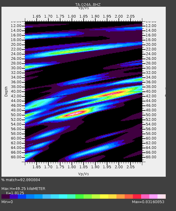
Q24A Divide, CO, USA - Earthquake Result Viewer
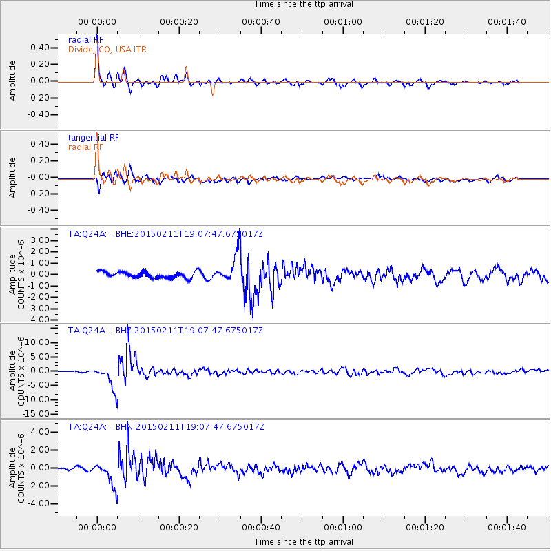
Earthquake location: Jujuy Province, Argentina
Earthquake latitude/longitude: -23.1/-66.7
Earthquake time(UTC): 2015/02/11 (042) 18:57:22 GMT
Earthquake Depth: 223 km
Earthquake Magnitude: 6.7 MWW, 6.7 MWC, 6.7 MWB, 6.9 MI
Earthquake Catalog/Contributor: NEIC PDE/NEIC COMCAT
Network: TA USArray Transportable Network (new EarthScope stations)
Station: Q24A Divide, CO, USA
Lat/Lon: 38.96 N/105.15 W
Elevation: 2775 m
Distance: 71.5 deg
Az: 329.246 deg
Baz: 142.848 deg
Ray Param: 0.05367504
Estimated Moho Depth: 49.25 km
Estimated Crust Vp/Vs: 1.81
Assumed Crust Vp: 6.159 km/s
Estimated Crust Vs: 3.398 km/s
Estimated Crust Poisson's Ratio: 0.28
Radial Match: 92.890884 %
Radial Bump: 293
Transverse Match: 82.90562 %
Transverse Bump: 400
SOD ConfigId: 7019011
Insert Time: 2019-04-16 18:17:51.458 +0000
GWidth: 2.5
Max Bumps: 400
Tol: 0.001

Signal To Noise

ChannelStoNSTALTA
TA:Q24A: :BHZ:20150211T19:07:47.675017Z20.8487054.351239E-62.0870549E-7
TA:Q24A: :BHN:20150211T19:07:47.675017Z8.8063721.3631085E-61.5478662E-7
TA:Q24A: :BHE:20150211T19:07:47.675017Z4.8647291.3257653E-62.7252605E-7
Arrivals
Ps6.7 SECOND
PpPs22 SECOND
PsPs/PpSs29 SECOND