You are here: Home > Network List > TA - USArray Transportable Network (new EarthScope stations) Stations List
> Station Q53A Leroy, WV, USA > Earthquake Result Viewer
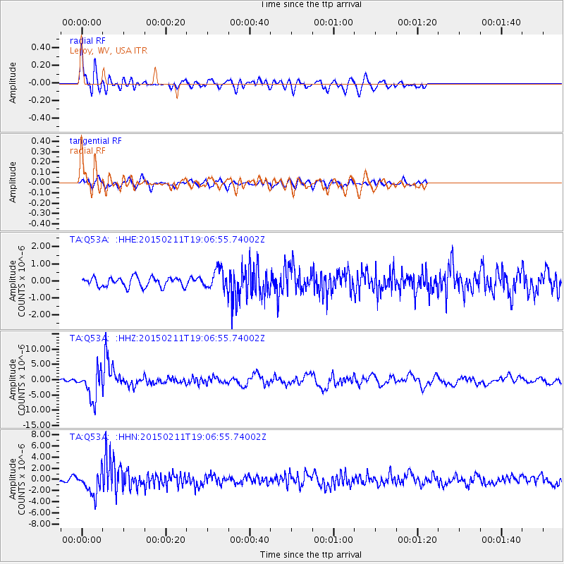
Q53A Leroy, WV, USA - Earthquake Result Viewer
*The percent match for this event was below the threshold and hence no stack was calculated.
| Earthquake location: |
Jujuy Province, Argentina |
| Earthquake latitude/longitude: |
-23.1/-66.7 |
| Earthquake time(UTC): |
2015/02/11 (042) 18:57:22 GMT |
| Earthquake Depth: |
223 km |
| Earthquake Magnitude: |
6.7 MWW, 6.7 MWC, 6.7 MWB, 6.9 MI |
| Earthquake Catalog/Contributor: |
NEIC PDE/NEIC COMCAT |
|
| Network: |
TA USArray Transportable Network (new EarthScope stations) |
| Station: |
Q53A Leroy, WV, USA |
| Lat/Lon: |
38.86 N/81.53 W |
| Elevation: |
310 m |
|
| Distance: |
63.2 deg |
| Az: |
347.058 deg |
| Baz: |
164.685 deg |
| Ray Param: |
$rayparam |
*The percent match for this event was below the threshold and hence was not used in the summary stack. |
|
| Radial Match: |
71.088875 % |
| Radial Bump: |
400 |
| Transverse Match: |
64.6794 % |
| Transverse Bump: |
400 |
| SOD ConfigId: |
7019011 |
| Insert Time: |
2019-04-16 18:17:52.800 +0000 |
| GWidth: |
2.5 |
| Max Bumps: |
400 |
| Tol: |
0.001 |
|
Signal To Noise
| Channel | StoN | STA | LTA |
| TA:Q53A: :HHZ:20150211T19:06:55.74002Z | 11.7658 | 4.8997586E-6 | 4.164407E-7 |
| TA:Q53A: :HHN:20150211T19:06:55.74002Z | 5.2190967 | 2.0935845E-6 | 4.0113926E-7 |
| TA:Q53A: :HHE:20150211T19:06:55.74002Z | 2.322946 | 6.443739E-7 | 2.7739515E-7 |
| Arrivals |
| Ps | |
| PpPs | |
| PsPs/PpSs | |


