
R57A Stanardsville, VA, USA - Earthquake Result Viewer
| ||||||||||||||||||
| ||||||||||||||||||
| ||||||||||||||||||
|

Signal To Noise
| Channel | StoN | STA | LTA |
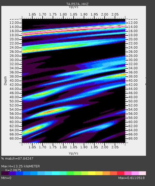
| TA:R57A: :HHZ:20150211T19:06:48.430022Z | 13.251021 | 4.1435005E-6 | 3.1269292E-7 |
| TA:R57A: :HHN:20150211T19:06:48.430022Z | 12.219955 | 1.8215046E-6 | 1.4905983E-7 |
| TA:R57A: :HHE:20150211T19:06:48.430022Z | 1.9365742 | 4.3743415E-7 | 2.258804E-7 |
| Arrivals | |
| Ps | 2.4 SECOND |
| PpPs | 6.4 SECOND |
| PsPs/PpSs | 8.8 SECOND |

