You are here: Home > Network List > II - Global Seismograph Network (GSN - IRIS/IDA) Stations List
> Station KDAK Kodiak Island, Alaska, USA > Earthquake Result Viewer
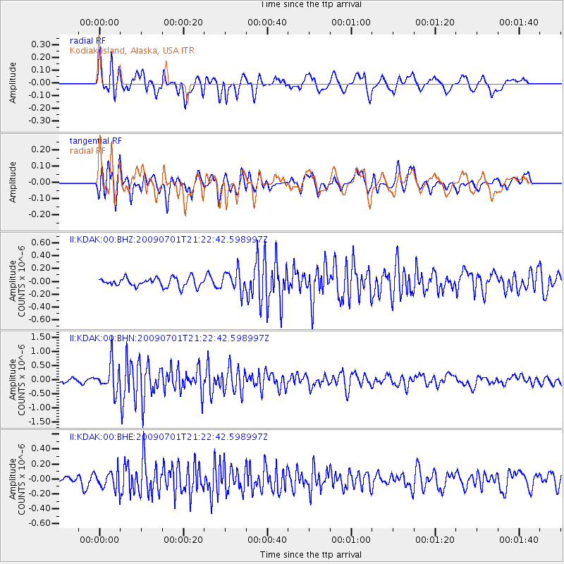
KDAK Kodiak Island, Alaska, USA - Earthquake Result Viewer
*The percent match for this event was below the threshold and hence no stack was calculated.
| Earthquake location: |
Northern Molucca Sea |
| Earthquake latitude/longitude: |
1.1/126.0 |
| Earthquake time(UTC): |
2009/07/01 (182) 21:10:44 GMT |
| Earthquake Depth: |
37 km |
| Earthquake Magnitude: |
5.7 MB, 5.3 MS, 5.8 MW, 5.8 MW |
| Earthquake Catalog/Contributor: |
WHDF/NEIC |
|
| Network: |
II Global Seismograph Network (GSN - IRIS/IDA) |
| Station: |
KDAK Kodiak Island, Alaska, USA |
| Lat/Lon: |
57.78 N/152.58 W |
| Elevation: |
152 m |
|
| Distance: |
84.5 deg |
| Az: |
32.151 deg |
| Baz: |
263.326 deg |
| Ray Param: |
$rayparam |
*The percent match for this event was below the threshold and hence was not used in the summary stack. |
|
| Radial Match: |
69.058876 % |
| Radial Bump: |
400 |
| Transverse Match: |
67.90415 % |
| Transverse Bump: |
400 |
| SOD ConfigId: |
2622 |
| Insert Time: |
2010-03-01 21:13:00.993 +0000 |
| GWidth: |
2.5 |
| Max Bumps: |
400 |
| Tol: |
0.001 |
|
Signal To Noise
| Channel | StoN | STA | LTA |
| II:KDAK:00:BHN:20090701T21:22:42.598997Z | 6.7043185 | 5.189067E-7 | 7.7398866E-8 |
| II:KDAK:00:BHE:20090701T21:22:42.598997Z | 2.1625884 | 1.2317037E-7 | 5.6955063E-8 |
| II:KDAK:00:BHZ:20090701T21:22:42.598997Z | 2.3265386 | 1.6065803E-7 | 6.9054536E-8 |
| Arrivals |
| Ps | |
| PpPs | |
| PsPs/PpSs | |


