You are here: Home > Network List > TA - USArray Transportable Network (new EarthScope stations) Stations List
> Station T56A Rocky Mt, VA, USA > Earthquake Result Viewer
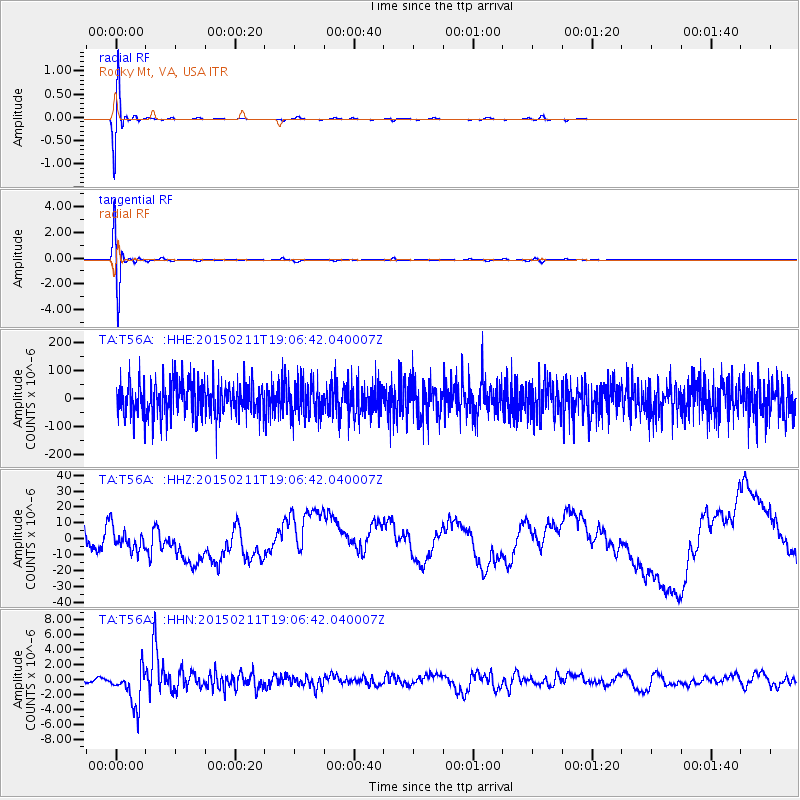
T56A Rocky Mt, VA, USA - Earthquake Result Viewer
*The percent match for this event was below the threshold and hence no stack was calculated.
| Earthquake location: |
Jujuy Province, Argentina |
| Earthquake latitude/longitude: |
-23.1/-66.7 |
| Earthquake time(UTC): |
2015/02/11 (042) 18:57:22 GMT |
| Earthquake Depth: |
223 km |
| Earthquake Magnitude: |
6.7 MWW, 6.7 MWC, 6.7 MWB, 6.9 MI |
| Earthquake Catalog/Contributor: |
NEIC PDE/NEIC COMCAT |
|
| Network: |
TA USArray Transportable Network (new EarthScope stations) |
| Station: |
T56A Rocky Mt, VA, USA |
| Lat/Lon: |
37.03 N/80.03 W |
| Elevation: |
387 m |
|
| Distance: |
61.1 deg |
| Az: |
347.827 deg |
| Baz: |
165.959 deg |
| Ray Param: |
$rayparam |
*The percent match for this event was below the threshold and hence was not used in the summary stack. |
|
| Radial Match: |
78.08805 % |
| Radial Bump: |
400 |
| Transverse Match: |
79.36301 % |
| Transverse Bump: |
400 |
| SOD ConfigId: |
7019011 |
| Insert Time: |
2019-04-16 18:18:13.424 +0000 |
| GWidth: |
2.5 |
| Max Bumps: |
400 |
| Tol: |
0.001 |
|
Signal To Noise
| Channel | StoN | STA | LTA |
| TA:T56A: :HHZ:20150211T19:06:42.040007Z | 0.32116106 | 6.604141E-6 | 2.0563331E-5 |
| TA:T56A: :HHN:20150211T19:06:42.040007Z | 8.672671 | 2.4962605E-6 | 2.8783066E-7 |
| TA:T56A: :HHE:20150211T19:06:42.040007Z | 0.9785333 | 5.9217615E-5 | 6.0516704E-5 |
| Arrivals |
| Ps | |
| PpPs | |
| PsPs/PpSs | |


