You are here: Home > Network List > II - Global Seismograph Network (GSN - IRIS/IDA) Stations List
> Station KDAK Kodiak Island, Alaska, USA > Earthquake Result Viewer
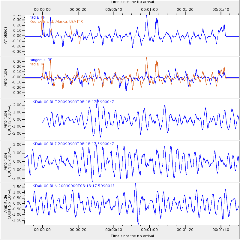
KDAK Kodiak Island, Alaska, USA - Earthquake Result Viewer
*The percent match for this event was below the threshold and hence no stack was calculated.
| Earthquake location: |
Northern Molucca Sea |
| Earthquake latitude/longitude: |
2.4/126.0 |
| Earthquake time(UTC): |
2009/09/09 (252) 08:06:33 GMT |
| Earthquake Depth: |
107 km |
| Earthquake Magnitude: |
5.6 MB, 5.7 MW |
| Earthquake Catalog/Contributor: |
WHDF/NEIC |
|
| Network: |
II Global Seismograph Network (GSN - IRIS/IDA) |
| Station: |
KDAK Kodiak Island, Alaska, USA |
| Lat/Lon: |
57.78 N/152.58 W |
| Elevation: |
152 m |
|
| Distance: |
83.4 deg |
| Az: |
32.224 deg |
| Baz: |
264.006 deg |
| Ray Param: |
$rayparam |
*The percent match for this event was below the threshold and hence was not used in the summary stack. |
|
| Radial Match: |
43.756023 % |
| Radial Bump: |
400 |
| Transverse Match: |
59.26273 % |
| Transverse Bump: |
400 |
| SOD ConfigId: |
2622 |
| Insert Time: |
2010-03-01 21:14:00.247 +0000 |
| GWidth: |
2.5 |
| Max Bumps: |
400 |
| Tol: |
0.001 |
|
Signal To Noise
| Channel | StoN | STA | LTA |
| II:KDAK:00:BHZ:20090909T08:18:17.599004Z | 0.59159684 | 4.1982955E-7 | 7.096548E-7 |
| II:KDAK:00:BHN:20090909T08:18:17.599004Z | 1.1833032 | 6.209684E-7 | 5.247754E-7 |
| II:KDAK:00:BHE:20090909T08:18:17.599004Z | 3.178105 | 1.7019636E-6 | 5.3552776E-7 |
| Arrivals |
| Ps | |
| PpPs | |
| PsPs/PpSs | |


