HEBO Mt. Hebo, OR CREST BB SMO - Earthquake Result Viewer
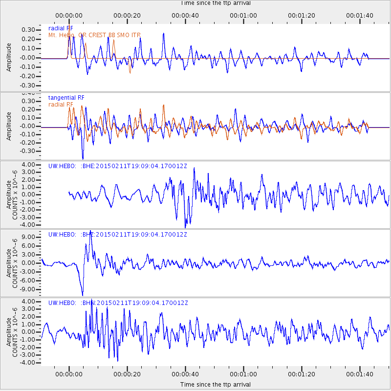
Earthquake location: Jujuy Province, Argentina
Earthquake latitude/longitude: -23.1/-66.7
Earthquake time(UTC): 2015/02/11 (042) 18:57:22 GMT
Earthquake Depth: 223 km
Earthquake Magnitude: 6.7 MWW, 6.7 MWC, 6.7 MWB, 6.9 MI
Earthquake Catalog/Contributor: NEIC PDE/NEIC COMCAT
Network: UW Pacific Northwest Regional Seismic Network
Station: HEBO Mt. Hebo, OR CREST BB SMO
Lat/Lon: 45.21 N/123.76 W
Elevation: 875 m
Distance: 85.5 deg
Az: 323.484 deg
Baz: 129.186 deg
Ray Param: 0.044163167
Estimated Moho Depth: 31.0 km
Estimated Crust Vp/Vs: 1.91
Assumed Crust Vp: 6.566 km/s
Estimated Crust Vs: 3.438 km/s
Estimated Crust Poisson's Ratio: 0.31
Radial Match: 82.67529 %
Radial Bump: 400
Transverse Match: 71.16573 %
Transverse Bump: 400
SOD ConfigId: 7019011
Insert Time: 2019-04-16 18:19:42.353 +0000
GWidth: 2.5
Max Bumps: 400
Tol: 0.001

Signal To Noise

ChannelStoNSTALTA
UW:HEBO: :BHZ:20150211T19:09:04.170012Z7.15827474.158779E-65.8097504E-7
UW:HEBO: :BHN:20150211T19:09:04.170012Z1.15065566.5145537E-75.6616017E-7
UW:HEBO: :BHE:20150211T19:09:04.170012Z1.66861341.008963E-66.046715E-7
Arrivals
Ps4.4 SECOND
PpPs13 SECOND
PsPs/PpSs18 SECOND