You are here: Home > Network List > II - Global Seismograph Network (GSN - IRIS/IDA) Stations List
> Station KDAK Kodiak Island, Alaska, USA > Earthquake Result Viewer
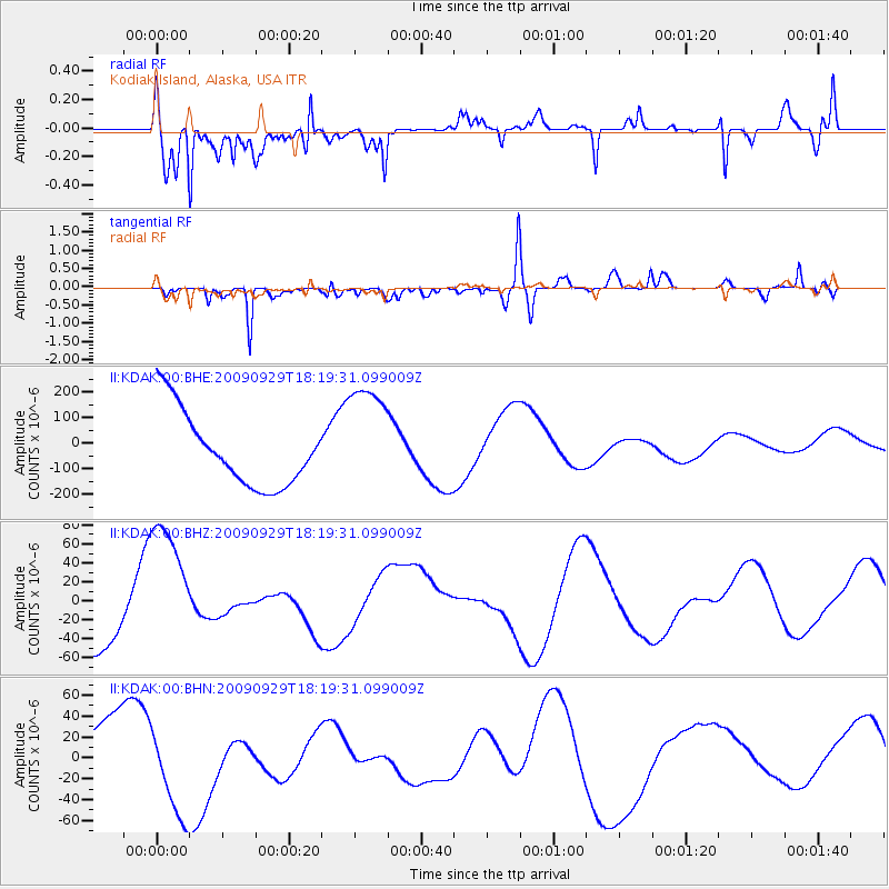
KDAK Kodiak Island, Alaska, USA - Earthquake Result Viewer
*The percent match for this event was below the threshold and hence no stack was calculated.
| Earthquake location: |
Samoa Islands Region |
| Earthquake latitude/longitude: |
-15.6/-172.0 |
| Earthquake time(UTC): |
2009/09/29 (272) 18:08:21 GMT |
| Earthquake Depth: |
10 km |
| Earthquake Magnitude: |
5.6 MB |
| Earthquake Catalog/Contributor: |
WHDF/NEIC |
|
| Network: |
II Global Seismograph Network (GSN - IRIS/IDA) |
| Station: |
KDAK Kodiak Island, Alaska, USA |
| Lat/Lon: |
57.78 N/152.58 W |
| Elevation: |
152 m |
|
| Distance: |
74.8 deg |
| Az: |
10.641 deg |
| Baz: |
199.405 deg |
| Ray Param: |
$rayparam |
*The percent match for this event was below the threshold and hence was not used in the summary stack. |
|
| Radial Match: |
56.32153 % |
| Radial Bump: |
351 |
| Transverse Match: |
36.691307 % |
| Transverse Bump: |
400 |
| SOD ConfigId: |
2622 |
| Insert Time: |
2010-03-01 21:14:05.639 +0000 |
| GWidth: |
2.5 |
| Max Bumps: |
400 |
| Tol: |
0.001 |
|
Signal To Noise
| Channel | StoN | STA | LTA |
| II:KDAK:00:BHZ:20090929T18:19:31.099009Z | 2.4353917 | 7.3421E-5 | 3.0147512E-5 |
| II:KDAK:00:BHN:20090929T18:19:31.099009Z | 0.8615073 | 4.0441344E-5 | 4.694254E-5 |
| II:KDAK:00:BHE:20090929T18:19:31.099009Z | 1.5757375 | 2.266333E-4 | 1.4382682E-4 |
| Arrivals |
| Ps | |
| PpPs | |
| PsPs/PpSs | |


