ABPO Ambohimpanompo, Madagascar - Earthquake Result Viewer
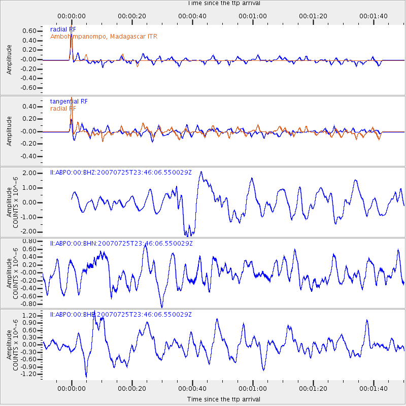
Earthquake location: Nicobar Islands, India Region
Earthquake latitude/longitude: 7.2/92.5
Earthquake time(UTC): 2007/07/25 (206) 23:37:31 GMT
Earthquake Depth: 15 km
Earthquake Magnitude: 5.5 MB, 6.1 MS, 6.1 MW, 6.0 MW
Earthquake Catalog/Contributor: WHDF/NEIC
Network: II Global Seismograph Network (GSN - IRIS/IDA)
Station: ABPO Ambohimpanompo, Madagascar
Lat/Lon: 19.02 S/47.23 E
Elevation: 1528 m
Distance: 51.7 deg
Az: 239.012 deg
Baz: 64.048 deg
Ray Param: 0.06725953
Estimated Moho Depth: 23.0 km
Estimated Crust Vp/Vs: 1.60
Assumed Crust Vp: 6.642 km/s
Estimated Crust Vs: 4.151 km/s
Estimated Crust Poisson's Ratio: 0.18
Radial Match: 83.224815 %
Radial Bump: 400
Transverse Match: 49.11793 %
Transverse Bump: 400
SOD ConfigId: 2564
Insert Time: 2010-03-01 21:15:25.282 +0000
GWidth: 2.5
Max Bumps: 400
Tol: 0.001

Signal To Noise

ChannelStoNSTALTA
II:ABPO:00:BHN:20070725T23:46:06.550029Z0.91965452.8506037E-73.0996463E-7
II:ABPO:00:BHE:20070725T23:46:06.550029Z2.16469294.3417754E-72.0057234E-7
II:ABPO:00:BHZ:20070725T23:46:06.550029Z1.79453955.76535E-73.2127184E-7
Arrivals
Ps2.2 SECOND
PpPs8.4 SECOND
PsPs/PpSs11 SECOND