GNW Green Mountain (BB) - Earthquake Result Viewer
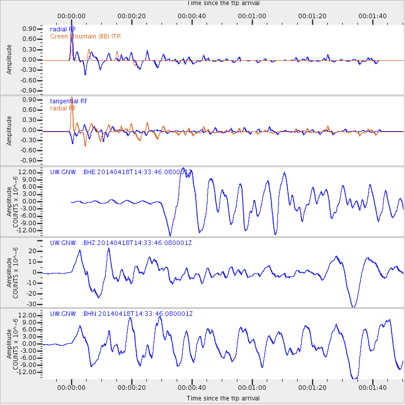
Earthquake location: Guerrero, Mexico
Earthquake latitude/longitude: 17.6/-100.8
Earthquake time(UTC): 2014/04/18 (108) 14:27:26 GMT
Earthquake Depth: 24 km
Earthquake Magnitude: 7.2 MWW, 7.0 MWB, 7.3 MWC, 7.5 MI
Earthquake Catalog/Contributor: NEIC PDE/NEIC COMCAT
Network: UW Pacific Northwest Regional Seismic Network
Station: GNW Green Mountain (BB)
Lat/Lon: 47.56 N/122.83 W
Elevation: 160 m
Distance: 35.0 deg
Az: 333.71 deg
Baz: 141.396 deg
Ray Param: 0.077436745
Estimated Moho Depth: 38.75 km
Estimated Crust Vp/Vs: 2.01
Assumed Crust Vp: 6.566 km/s
Estimated Crust Vs: 3.271 km/s
Estimated Crust Poisson's Ratio: 0.33
Radial Match: 89.73503 %
Radial Bump: 383
Transverse Match: 91.02103 %
Transverse Bump: 368
SOD ConfigId: 626651
Insert Time: 2014-05-02 15:14:00.371 +0000
GWidth: 2.5
Max Bumps: 400
Tol: 0.001

Signal To Noise

ChannelStoNSTALTA
UW:GNW: :BHZ:20140418T14:33:46.080001Z41.0840571.1153702E-52.714849E-7
UW:GNW: :BHN:20140418T14:33:46.080001Z22.227034.0354394E-61.8155549E-7
UW:GNW: :BHE:20140418T14:33:46.080001Z17.3641667.5919456E-64.3721914E-7
Arrivals
Ps6.4 SECOND
PpPs17 SECOND
PsPs/PpSs23 SECOND