You are here: Home > Network List > TA - USArray Transportable Network (new EarthScope stations) Stations List
> Station J01E Myrtle Point, OR, USA > Earthquake Result Viewer
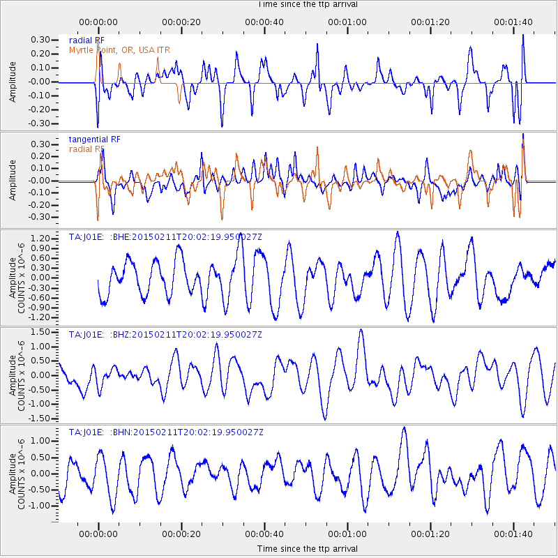
J01E Myrtle Point, OR, USA - Earthquake Result Viewer
*The percent match for this event was below the threshold and hence no stack was calculated.
| Earthquake location: |
Near North Coast Of Irian Jaya |
| Earthquake latitude/longitude: |
-2.7/139.0 |
| Earthquake time(UTC): |
2015/02/11 (042) 19:49:23 GMT |
| Earthquake Depth: |
37 km |
| Earthquake Magnitude: |
4.7 mb |
| Earthquake Catalog/Contributor: |
ISC/ISC |
|
| Network: |
TA USArray Transportable Network (new EarthScope stations) |
| Station: |
J01E Myrtle Point, OR, USA |
| Lat/Lon: |
43.16 N/123.93 W |
| Elevation: |
128 m |
|
| Distance: |
96.9 deg |
| Az: |
47.018 deg |
| Baz: |
272.867 deg |
| Ray Param: |
$rayparam |
*The percent match for this event was below the threshold and hence was not used in the summary stack. |
|
| Radial Match: |
39.729153 % |
| Radial Bump: |
400 |
| Transverse Match: |
36.2877 % |
| Transverse Bump: |
400 |
| SOD ConfigId: |
7019011 |
| Insert Time: |
2019-04-16 18:28:30.410 +0000 |
| GWidth: |
2.5 |
| Max Bumps: |
400 |
| Tol: |
0.001 |
|
Signal To Noise
| Channel | StoN | STA | LTA |
| TA:J01E: :BHZ:20150211T20:02:19.950027Z | 0.9391423 | 3.3179023E-7 | 3.532907E-7 |
| TA:J01E: :BHN:20150211T20:02:19.950027Z | 1.2875344 | 7.314846E-7 | 5.681282E-7 |
| TA:J01E: :BHE:20150211T20:02:19.950027Z | 1.6045142 | 7.774521E-7 | 4.8454046E-7 |
| Arrivals |
| Ps | |
| PpPs | |
| PsPs/PpSs | |


